The Barnstaple and Ilfracombe railway opened in July 1874 thus 2024 is the 150th anniversary of the line’s opening. Despite opposition the line closed in October 1970 after British Railways had totally rationalised the line in an attempt to keep the costs of running it to a minimum. Ultimately the Government of the day was not satisfied and ordered it shut. For more than a decade the route remained in a derelict state pending a possible restoration bid. The tracks lay moribund for a few more years whilst the possibility of reopening remained however remote it was. Eventually the track was taken up and the curved iron bridge across the Taw at Barnstaple was removed. Stations at Barnstaple Town, Wrafton, Braunton, even part of Ilfracombe, remained for a good few more years, trackless and in a rather untidy and unkept state – and that’s how I remember Braunton station in 1980.
Around half of the route now constitutes the Tarka Trail which stretches round both sides of the Taw estuary from Bidford to Braunton and there has even been talk of a light rail route from Barnstaple to Braunton utilising the old railway alignment. A good part of the route runs alongside both the Taw estuary and the airbase at Chivenor. Much of the route to Ilfracombe is in fact walkable and can be used by cyclists. Barnstaple to Georgeham gates is a public right of way and forms part of the Tarka Trail. Willingcott to Ilfracombe is too a public right of way. Alas the section which constituted one of England’s more arduous railways with a six hundred foot climb in just six miles from St. Brannock’s to Willingcott is largely inaccessible and parts of it has been obliterated or built over.
Next is a gallery of pictures showing what remains of the Ilfracombe Line today…. its by no means a complete and comprehensive detail of the line as it is now. I’ve used Google Streets, Instagram and Twitter to illustrate the pictures. The sections covered are:
A) Barnstaple to Braunton.
B) Braunton to Willingcott
C) Willingcott to Ilfracombe.
Barnstaple Junction to Braunton
We start off with a map. I devised three of these to cover the former railway route and utilised the media from Open Street Map for the purpose. The maps cover the sections as follows: a) Barnstaple to Braunton, b) Braunton to Willingcott and c) Willingcott to Ilfracombe.
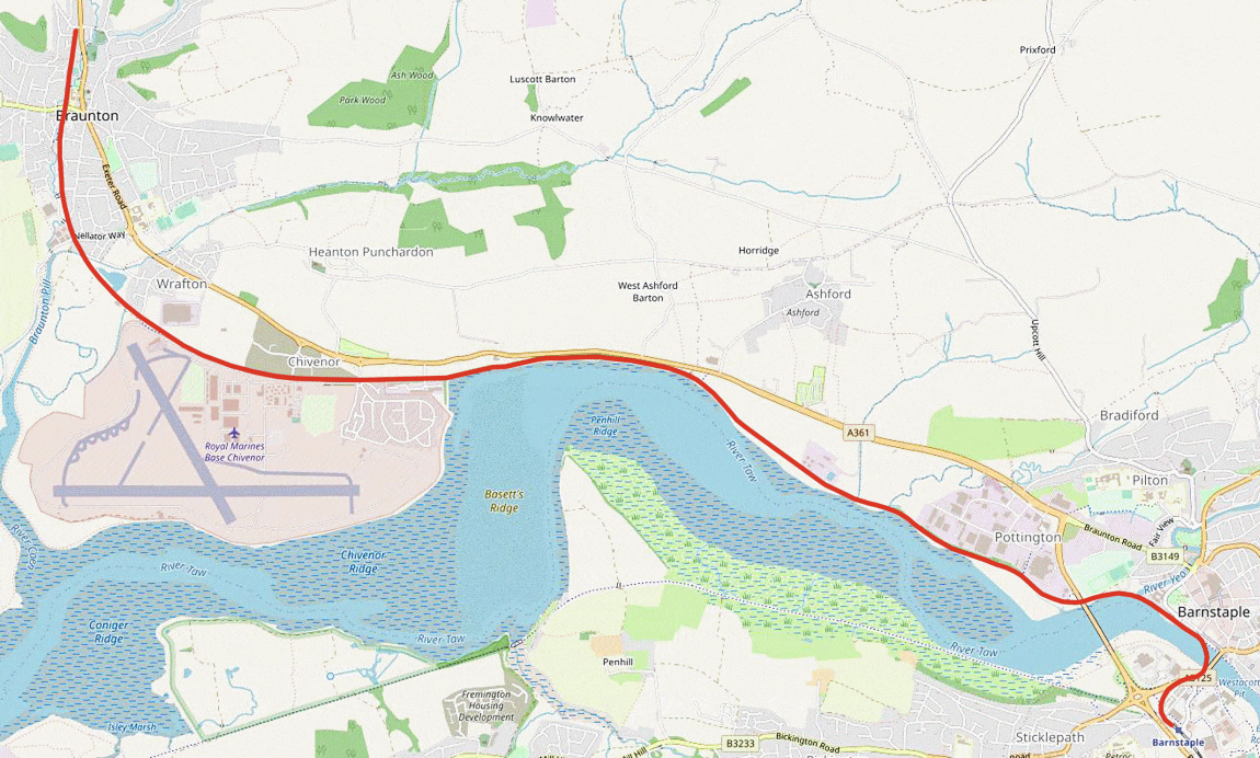
The railway’s route (and in part the Tarka trail) from Barnstaple Junction to Wrafton and Braunton. Ashford limekiln bridge is about halfway along the route. This section is no doubt the better known part of the railway’s former alignment as it also constitutes an important public and busy shared path – part of the Tarka Trail – between the two towns. There’s a number of signals still standing plus gradient posts as well as overbridges and rails set into the roadways where there were crossings. This was a relatively easy graded route mostly alongside the Taw river estuary before passing the military base at Chivenor and featuring one intermediate station at Wrafton.
1) Barnstaple Junction to the river Taw
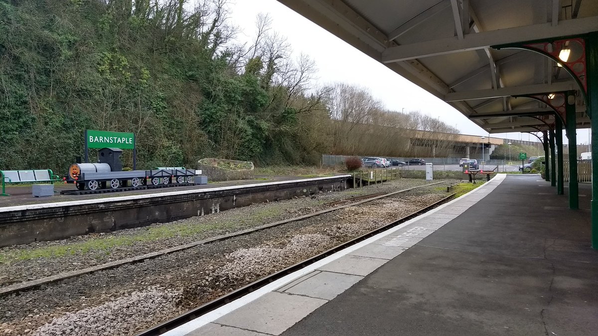
Barnstaple Junction station (39 and half miles from Exeter) no longer exists. Its simply known as Barnstaple and no longer a junction. This is one of those medium sized town stations that once had several platforms and a substantial layout – and one that now sports a single platform and the other whatsits which are obligatory in making sure its as barebones as can be. Fortunately there are still facilities including a ticket office, waiting room and cafe but it doesn’t make up for the huge rationalisations that have been implemented – and the fact it is essentially a bus stop style terminus.
Nevertheless there are some efforts by individuals or dedicated rail staff to show some of the station’s former glory. The other platform can be reached by the public in order to admire its gardens and there is seating upon which one can these days wonder how the station ever morphed from a major junction into the motley terminus it is today. The station has won awards for best station so clearly there is a desire to keep a sense of character at the station in spite of its adversity. Its really not the same though when one sees the pictures of it as it was in its heyday.
The station as it is today with the gardens and public seating area on the island platform. Formerly the tracks headed straight on for Bideford and right for Ilfracombe. Source: Twitter
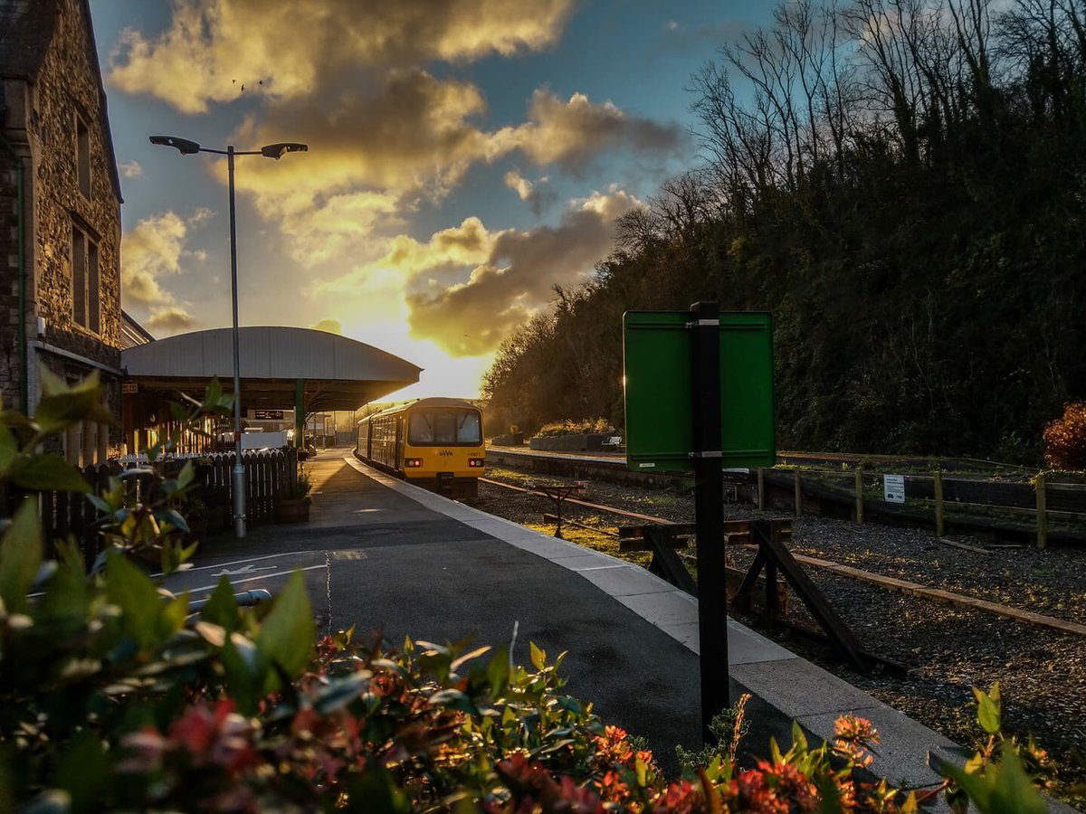
A lovely view of Barnstaple station with a Pacer. Don’t we just love these! They’ve all gone from the rail system now much to the relief of many! A comparable view can be seen from Google Streets featuring a Pacer too if that is something one really wants! If one turns that Google scene round they’ll be looking across the station car park which is where the picture of that comes in. Source: Twitter

The Barnstaple Town and Ilfracombe line split off immediately at the western end of the up platform (this being the current platform) although it too was served by track leading straight off platforms two and three. The track passed through the adjacent road bridge, now no longer extant – and the location is now the site of the car park adjacent to the station as the next view shows. The picture was taken in the days when the line to Meeth was still in use for freight. Source: Twitter
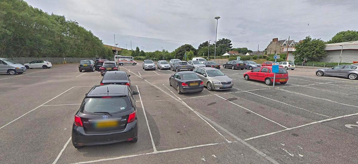
Looking the other way from the station perimeter. The whole area here that is now a car park was once the ‘Y’ shaped junction (plus a small secondary goods yard to the right) for the lines to both Torrington and Ilfracombe. The Torrington route headed for the modern bridge visible straight ahead whilst Ilfracome’s headed towards the houses on the right. The cottage with white wall and chimneys can be better viewed in the picture below. Source: Google Streets
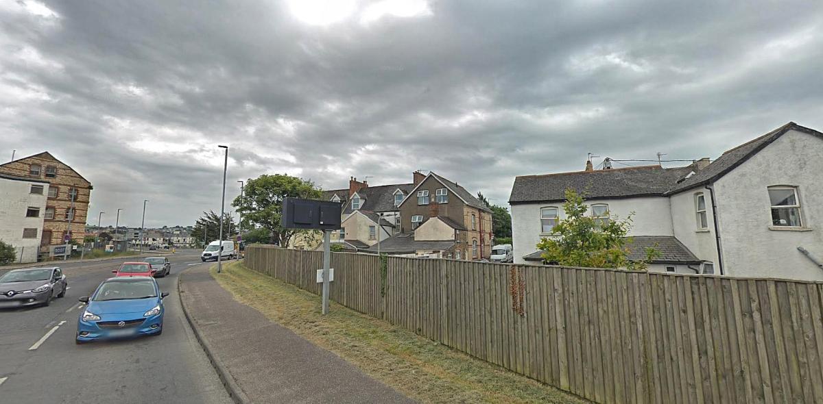
It might seem to the casual observer hereabouts there is absolutely no trace of the Ilfracombe line anymore but the line did in fact pass behind the terrace of houses on Sticklepath – and if one looks at Google aerial it can be seen the houses form an arc which formed a boundary alongside the railway itself. Here’s a picture of the alignment after the former railway had been turned into a small park.

Before the new road layout and bridges were built the former Ilfracombe trackbed could be seen making its way behind the Sticklepath cottages. This view is from the old railway bridge circa late 1980s or early 1990s when the line to Meeth was still in use. Source: Twitter
View looking from Barnstaple Junction towards the Taw River crossing. Source: Google Streets
Note the clip shown below from this 1970 film of somewhat poor quality showing a train in the line’s final days passing the houses visible in the modern scene above! Also the terracotta brick warehouse seen on the left is just visible at left in the clip too.
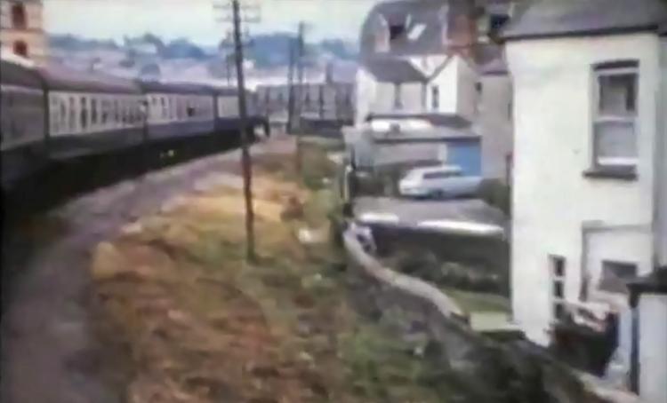
The white cottage on the right is clearly evident here as are the other houses behind. Source: You Tube
The current main road A3125 lies on part of the route and there’s very little to indicate there was once a railway through this part of Barnstaple!
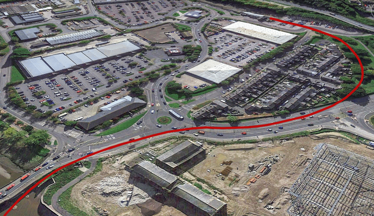
Aerial I created from Google Earth showing the railway’s exact alignment between Barnstaple Junction and the river. The perspective makes the route look a little squashed compared to how it looks as a near perfect ‘S’ on the Ordnance Survey maps. The purpose however is to show where the line stood in relation to the modern road layout.