Its intriguing to see Trekking Exploration’s (formerly Trekking and Towpaths) walk along the Cromford Canal! So far there have been three videos covering this. First there was the canal from Langley Mill to the Beggarlee diversion, then the Pinxton arm and the local railways, and thirdly the walk up the Golden Valley to the Butterley tunnel and over the top to Hammersmith and Hartshay wharf. I don’t normally write about videos on Youtube – and not in relation to canals either. However one was written about Martin Zero’s videos covering James Brindley and the Wet Earth colliery. This featured the Manchester Bolton and Bury plus Fletcher’s canal. Martin Zero’s video centered around the celebrated works that James Brindley had devised – and which made ‘water go uphill.’ I wrote about that because I had done quite a bit of research on Brindley and Wet Earth in the 1970s. See Brindley and Wet Earth Colliery (March 2020).
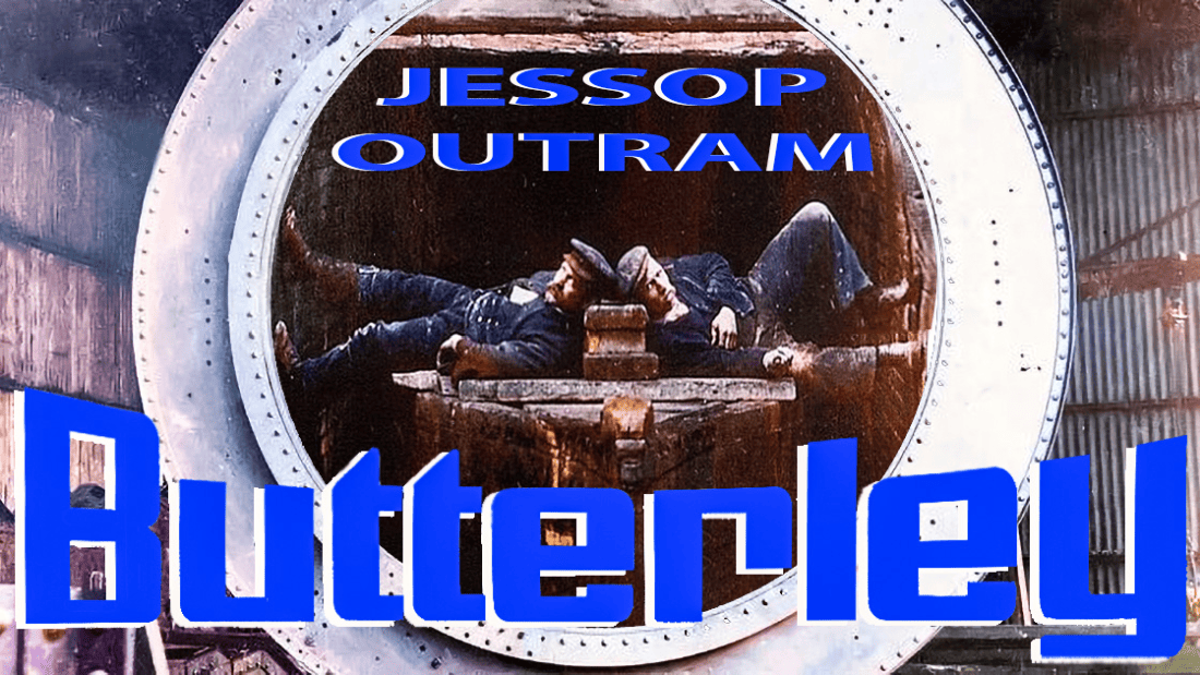
Thus we move from one canal engineered by James Brindley to another engineered by William Jessop. He was the engineer to the Cromford canal and also part owner (along with Benjamin Outram) of the Butterley works, so the canal was advantageous for the new iron works – as well as heading through the hills to the Derwent Valley in order to serve Richard Arkwright’s works at Cromford. Butterley Ironworks is famous for its product and perhaps the most visible from those works that can be seen in London are the huge vertical cast iron trusses and roof span plus decorative bases stamped with Butterley Company at St. Pancras station – and these are no doubt the most enduring.
Anyhow, the Cromford Canal was one of my earlier solo explorations! A fair number of explorations of the inland waterways were usually with a mate or noted canal pioneers such as Bert Dunkley, C.R. Thomas (also one time trustee of the Railway and Canal Historical Society) and even David Hutchings MBE, the Chairman/Trustee of the Southern Stratford canal, the Lower, Upper Avon and the abortive Higher Avon Navigation. The Cromford I did on a number of occasions solely tied in with a visit to the High Peak, Crich’s trams or the nearby Heights of Abraham. The release of Trekking Exploration’s video on Butterley tunnel (which at the time of writing, was just one day ago) inspired me to write this quite unprepared feature covering the Cromford canal in 1977/78!
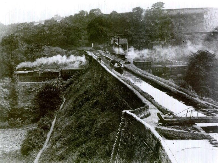
The long vanished Bullbridge embankment and aqueducts at Ambergate. The train is on the Midland main line from Sheffield to London. The company’s noted main line to Manchester via Matlock, the Peak District and Buxton, headed in the other direction from the nearby Ambergate station, which is now a shadow of its former importance as a major junction. The view looks in the direction of Hag tunnel (now demolished) and Cromford. The entire elevated structure was demolished in 1968. Bugsworth Basin.
There’s no doubt the Cromford is now being restored from Langley Mill northward and that includes an innovative diversion using the route of an old railway line! This is known as the Beggarlee extension which will take the route almost to Stoneyford locks. What happens after that is, well, anyone’s guess and that’s because of Butterley tunnel, but not just that, its from a point west of Buckland Hollow tunnel to the far side of the Ambergate valley the canal has been entirely obliterated. In any sense beyond Ironville & Codnor Park entails a huge engineering task in much the same vein as several other examples – eg Norwood tunnel on the Chesterfield canal, Lapal tunnel on the Dudley canal and Sapperton tunnel on the Thames & Severn. The canal through the Derwent valley to Whatstandwell and beyond is in a variable state of condition. From Lea Wood to High Peak Junction (for the Cromford and High Peak Railway) and Cromford wharf its well looked after.
Following is a selection of pictures scanned from my slides of the Cromford canal during 1977-1978. They’re not exactly brilliant – as always its the issue of trying to get high quality images from the slides.
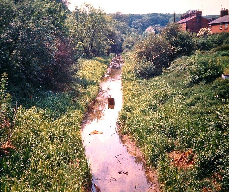
The Cromford canal at Codnor Park locks in 1977.
The Butterley Company’s Codnor Park ironworks were closed in 1965 thus my pictures were taken just twelve years later. There wasn’t a lot left of the ironworks. Any remaining buildings were basically shells.
Codnor Park top lock. The Pinxton branch leads off at right. Its been said the top lock was reduced in height during 1985 to reduce the risk of flooding. At the time of my visit the lock remained in its original condition and the water levels were normal. 7th June 1977.
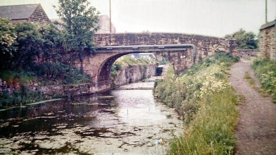
The route of the Cromford canal looking towards Newlands Road in the Golden Valley, Derbyshire 7th June 1977.
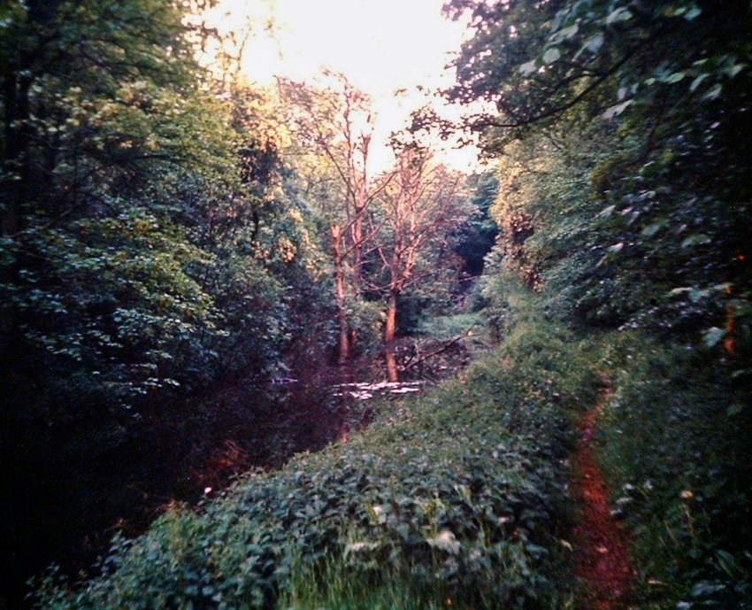
On the other side of Newlands Road looking in the direction of the Butterley tunnel portal. 7th June 1977.
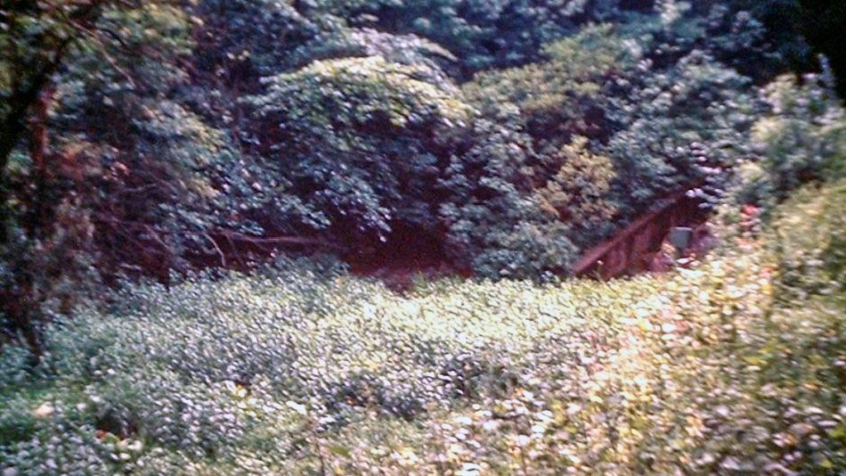
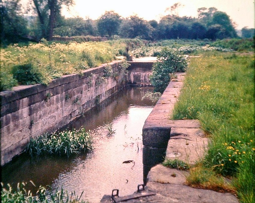
Not a brilliant picture but this is the entrance to Butterley tunnel, seen in the middle. A cascade weir from Butterley Reservoir can be seen at right. 7th June 1977. It was impossible to reach the tunnel portal at this time, however I did it a year later. See Trekking Exploration for comparable views (including a drone to the tunnel entrance).
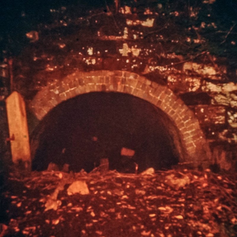
The entrance to Butterley tunnel, 26th August 1978.
Butterley tunnel was quite a long one, originally 2966 yards and later extended to 3063 yards when a railway was built across the western end. Despite popular consensus, boats were not regularly legged in the classical sense through the tunnel. They were more often poled through by men standing in the boat cabin’s hatch, or alternatively by lying down on the boat cabin and pushing with their legs. The maximum transit time was three hours. The tunnel was quite diminutive even though there was a passing place and an underground wharf about halfway through. Like the other similarly long tunnels at Norwood and Lapal, the journey through the one and three quarter mile (2.8km) long tunnel must have been quite claustrophobic. Boats entered the western (Hammersmith) end at 1 to 2am, 9 to 10am and 5 to 6pm. From the eastern end it was 5 to 6am, 1 to 2pm and 9 to 10pm.
Henry Rodolph de Salis found Butterley to be in one of the worse conditions he had ever found a canal tunnel. This was during 1893 or 1894 after major repairs had been done to a collapsed part of the tunnel – and he said it was ‘unsurpassed by any other I have ever seen.’ Another major collapse occurred on 5th July 1900, and this time the Midland Railway, the canal’s owners, were not prepared to undertake repairs. A further collapse occurred in 1907 thus the tunnel and the canal thence to Cromford was officially abandoned. The rest of the canal towards Langley Mill was abandoned in 1944, except the last half mile which was abandoned in 1962. (Most information is from an unfinished thesis I did in the 1970s on canal tunnels).
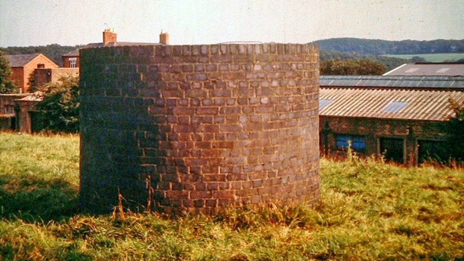
The eastern most air shaft 26th August 1978. The tops of these were reconstructed in the late 19th Century with blue bricks. These looked sturdy enough to clamber up the side and lean over the top in order to take a photograph!
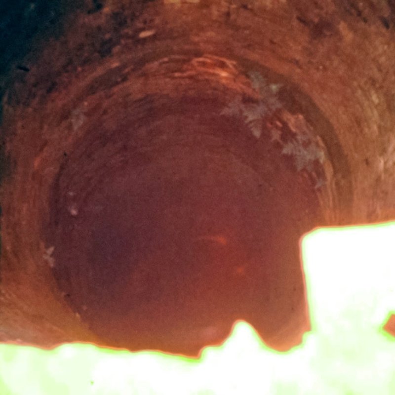
Looking down the air shaft with flash. Plants can be seen growing in the brickwork part way down. These shafts had irregular walls. 26th August 1978.
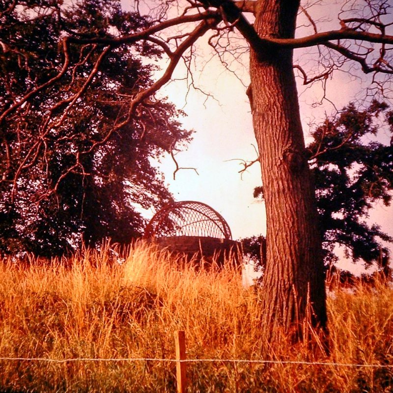
One of the other air shafts, capped with a grille. 26th August 1978. See Trekking Exploration for a comparable view.
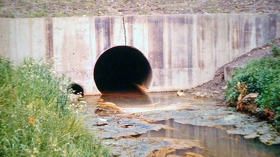
The other end at Hammersmith (Derbyshire) sometime in 1978. The culverted western end was built a year or so earlier to accommodate the new A38 by pass.
The Cromford canal had three further tunnels – all fairly short but complete with a towpath. The first is Buckland Hollow (to the east of Ambergate) – a partial view of the western portal can be seen on Google Streets. The next was Hag (or Hay) tunnel to the north of Ambergate. Its eastern portal was about where these new houses are on Google Streets. The other end of the tunnel was sited within what is now the National Gas Ambergate facility. No trace of the tunnel exists. The third is Gregory tunnel and the only one that is fully watered. Its about halfway between Whatstandwell and the Lea Wood aqueduct.
Leave a Reply