Of the river crossing itself there is barely anything to signify its former existence. On the north side of the river a widened section of quayside still denotes the northern end of the viaduct. This soon passes the original Barnstaple Quay station which was later replaced by Town station.
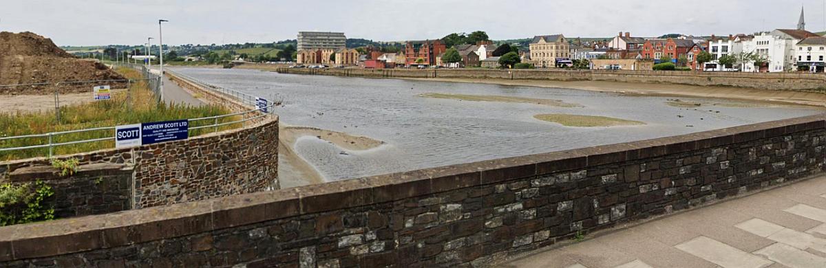
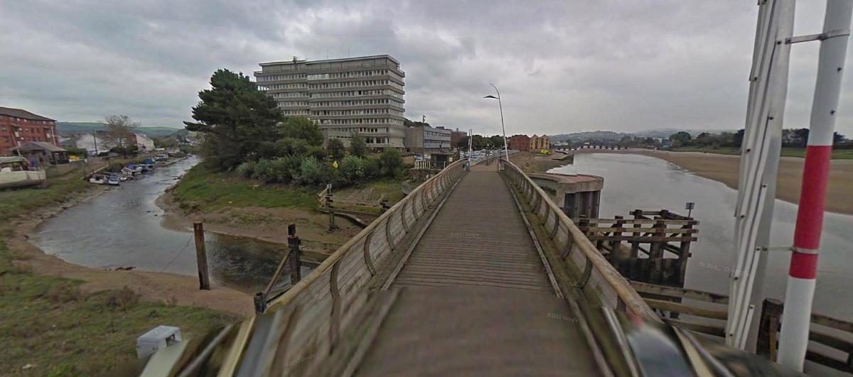
The site of the Taw bridge/viaduct. Part of the southern brick retaining wall can still be seen just behind the roadway. The other end of the viaduct can just be seen where the northern quayside widens out a bit. This is a composite of two images from Google Streets
A couple of years ago North Devon Council put forward proposals for a new footbridge over the river. The various options are touted on this plan. Call me biased but I’d certainly go for Option C!

In terms of those proposals mooted by North Devon Council as I say, I’d choose Option C. There’s no surprise why I’d choose that of of the five options for this is the original Option C! Source: Barnstaple History.
In the above pictures a number of buildings remain in both the older and newer views at the site where the railway bridge once crossed the River Taw.
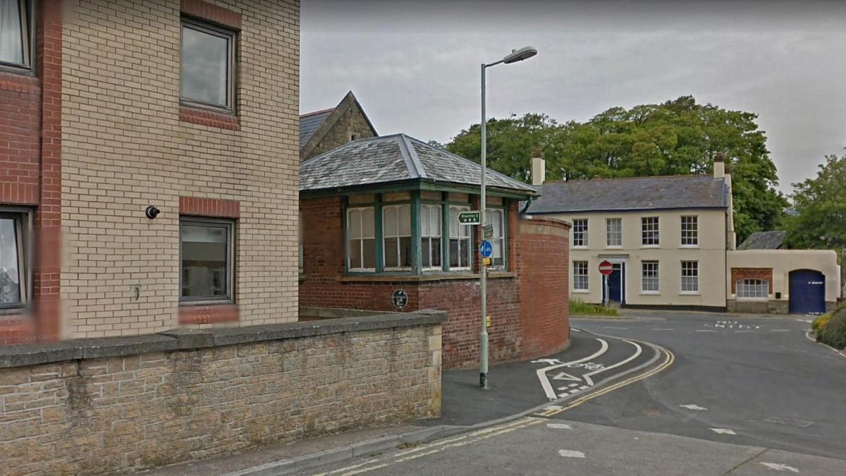
Tucked away down at the side of Castle Quay is the former signal box for Barnstaple Town station. A rather incongruous location! Source: Google Streets.

On the road behind the signal box (its roof can just be seen at left) is the station’s main frontage – the building nowadays is a school. Similar view at Google Streets. Source: Twitter
Barnstaple Town was exactly forty miles from Exeter.

The station’s canopies have been partially retained and incorporated into the school itself. Source: Twitter
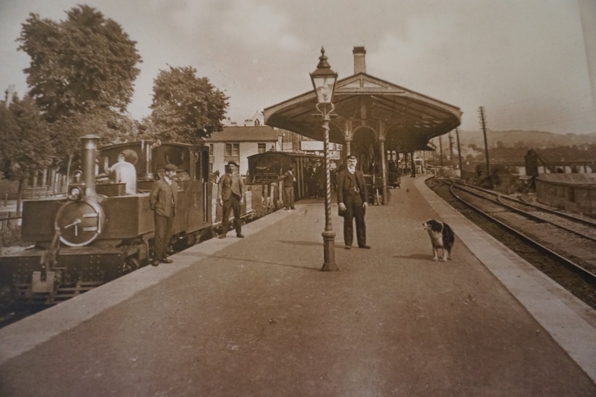
How it all looked then – Barnstaple Town station with a narrow gauge Lynton train waiting for a main line connection! Source: Twitter
Pottington Bridge over the River Yeo. The view looks south east along the quay with the large car park that forms an adjunct to the Civic Centre (aka North Devon Council headquarters building.) The railway swing bridge as once where this modern bridge is. Along the Yeo to the left was a branch line to Rolle Quay and opposite that was Pilton Yard, the centre of operations on the narrow gauge Lynton and Barnstaple line. Source: Google Streets
The modern Taw road bridge (constituting part of the Barnstaple Western By-Pass) is quite prominent along this stretch. It wasn’t there of course when the railway was operational! Ironically it was opened almost exactly thirty years after the railway’s own viaduct was demolished.
From Pottington the former railway alignment has a concrete wall alongside for most of its length as far as Ashford. Its a substantial wall which I assume was to protect the railway form the ravages of the river estuary. Its without a doubt the most enduring piece of the entire Ilfracombe line, and there are also some rail related items to be found, such as a number of gradient posts and a couple of overbridges.

Its straight ahead for Ilfracombe or right for Torrington (via the new Taw road bridge!) The lengthy concrete wall that forms the boundary between the former railway and the river is strongly evident in this view. The same location on Google Streets showing a wider view of the shared paths’ junction. Source: Twitter

Gradient post 1456 – 868 just past Pottington. – Source: Twitter.
Another view of gradient post 1456 – 868, looking back towards Barnstaple, can be seen on Google Streets.
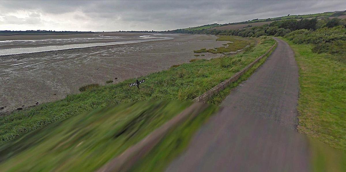
Level – 474 gradient post. Source Google Streets
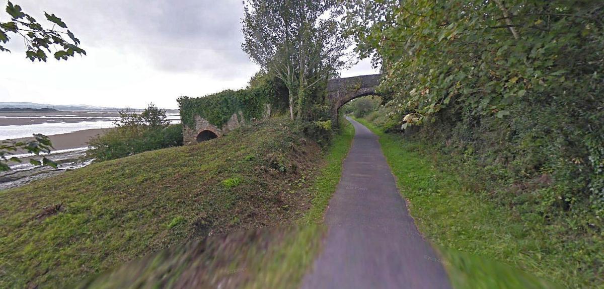
Ashford Limekiln bridge with small arch at left by river bank. Source: Google Streets
There was once a limekiln here which explains the rather curious arrangement seen in the picture and explains why the bridge appears to have two different arches. The end bit is the limekiln itself and an early contemporary view of the site before the railway was built can be seen at The Pilton Story. Here’s a closer view of the limekiln bridge on Google Streets. There too was a weir nearby, one of several dotted around the area. These weren’t weirs in the normal sense but fish traps in fact stretched across a good part of the river. The area had become very overgrown and personnel from Chivenor recently held an effort to clear up the site and provide new access paths, see North Devon Gazette.
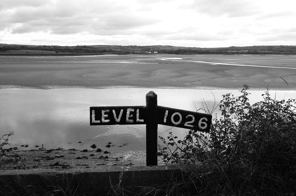
Level – 1026 near Heanton Court (aka The Tarka Inn). Source: Instagram. Different view on Google Streets.
Heanton Court aka the Tarka Inn, somewhat easily reached from the Tarka Trail. Source: Google Streets
The railway leaves the estuary and heads along the northern perimeter of RAF Chivenor – the approximate location where this occurs can be seen on Google Streets.
A short distance further on is the Waterside Cafe, a stop recommended by the Tarka Trail and others.

The next bridge is just before RAF Chivenor. The location can be found here at Google Streets. Source: Twitter.