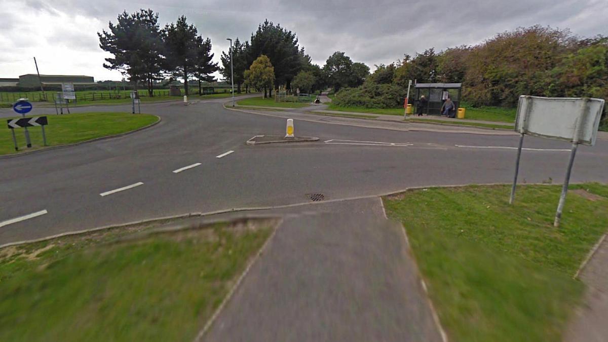
The site of the former road crossing at Duckpool – now a roundabout which primarily serves the base at Chivenor. Source: Google Streets
Although it is generally recognised this was Duckpool crossing, on much older maps its described as Chivenor crossing. It seems the name only changed after the line was double tracked in the late 19th Century.
RAF Chivenor is an important location in Britain’s defence and its helicopters are also on stand by to help with coastal incidents or people stranded on the Devon moors. The airbase was served by Wrafton station. Much of the airbase can be seen from the old railway as the route forms a boundary along the north side of the military base. The buildings at RAF Chivennor can be seen from the former railway alignment on Google Streets. This viewpoint is probably about where the eastern extremity of Wrafton station was.

Aerial of RAF Chivennor photographed during an airshow there in 1971. The closed Ilfracombe line runs along the top edge of the airfield. Wrafton station can just be discerned at top left. Source: Twitter

The signals at Wrafton. These can also be seen on Google Streets. Alas the crossing itself is no more. Source: Twitter
The original 1874 Wrafton station (44 and half miles from Exeter) was a simple affair – just one platform and a siding. The passing places in those days before the route was double tracked were at Braunton and Mortehoe. The station’s goods yard was expanded and a pair of platforms provided. Its ironic in the last years of the line the station reverted to a single track once again.
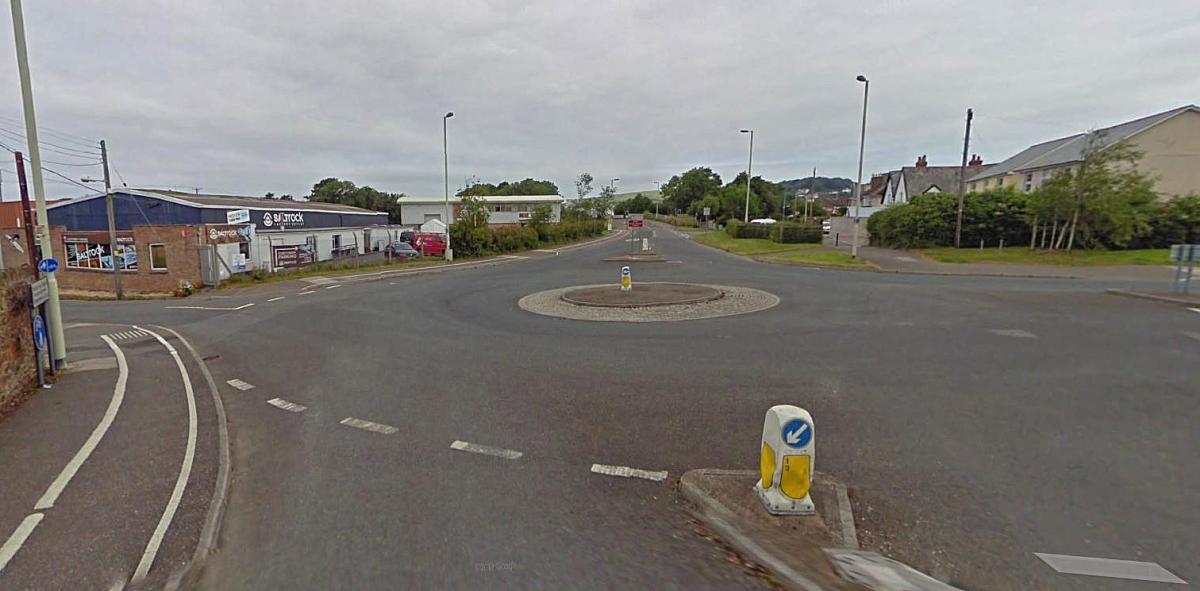
Another crossing site turned into major road intersection at Velator. The railway’s alignment was in the centre of the roundabout. Source: Google Streets
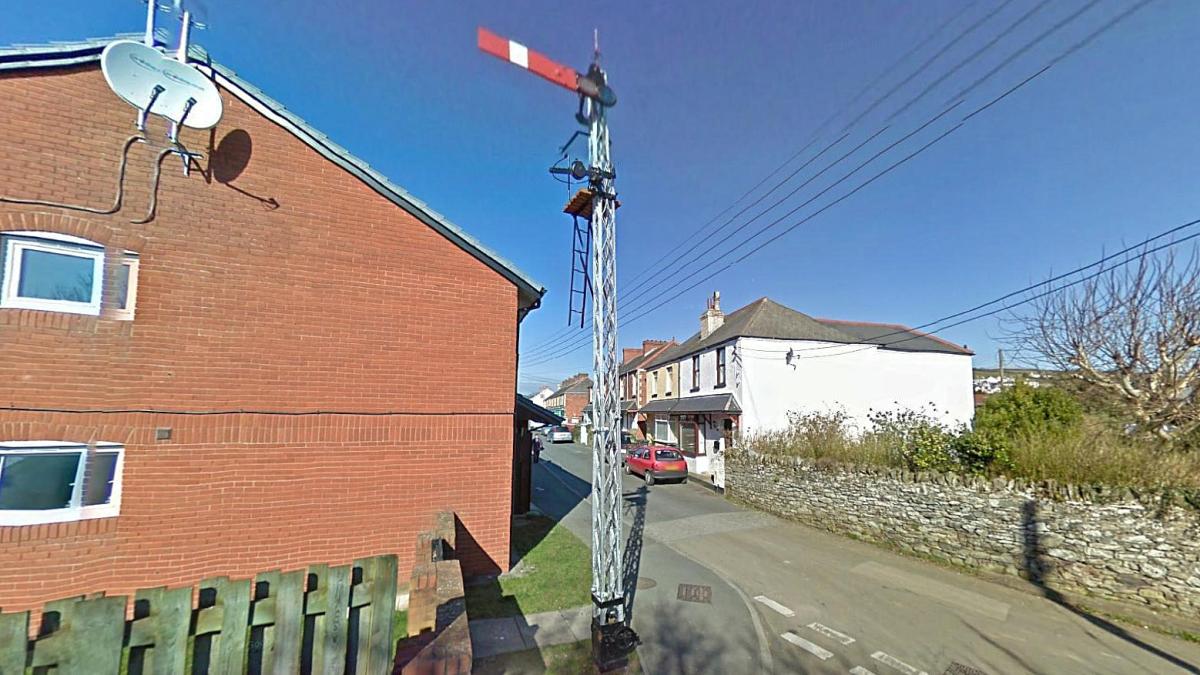
The down home signal at Braunton. Source: Google Streets
With regards to the above signal post, its evidently been moved. The post is very tightly upon the edge of the former railway boundary which somehow suggests it was in fact at this location. However there isn’t any justification for having a down signal on the up side of the line, the curvature here was ever so slight as to not even require any signals to be placed in a different location. The home signal at Braunton on official railway diagrams is shown on the other side (the down side) which shows its been moved from where it once was some distance further north. Even more evidence comes in the form of aerial pictures which shows the signal wasn’t ever in the location it is now!
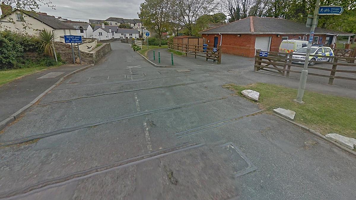
The site where Braunton Gates crossing used to be. This is just beyond where the platforms were sited. Source: Google Streets
Braunton station stood between a pair of level crossings, that at the southern end had its own cabin known as Braunton Gates. The other crossing at the northern end of the station was controlled by Braunton signal box. There was a goods yard and a pair of sidings on the down side which stabled locomotives awaiting the job of assisting heavy trains on the six hundred foot climb to Mortehoe & Woolacombe station. One of the surprises is in the line’s heyday both LSWR and Great Western locomotives were used as banking engines.
The goods shed was on the up side. The building still remains, much modified, and these days its home to the Museum of British Surfing.

The old goods shed is now the home of the Museum of British Surfing. This is where the road access was and it explains the large sliding doors to this side. Source: Twitter. The shed was about where the station’s down platform would have been. Another view on Google Streets.

Braunton station some years after the line had closed. The view looks north. Source: Tarka Trail
It is said the railway was line was purchased for £515,000 from British Rail in the late eighties in order to reuse the land and make a new trail towards Barnstaple!
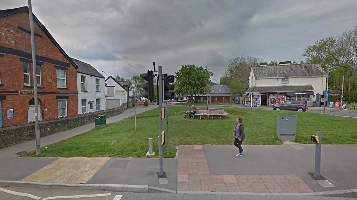
The site of the main road crossing at Braunton, looking south along what would have once been the station and its platforms. Source: Google Streets.
The white building across the green on the right, now a newsagents, is all that remains of the station buildings. This green in fact covers most of what was once the pair of platforms and tracks!
Its incredible to think I stood here all those years ago when the station and its crossing still existed! The platforms and trackbed were easily accessible because half of the crossing’s gates had disappeared – whether that was through accident or vandalism I do not know but I suspect the latter.
The red brick building at left is in fact that shown in the 1930s image below – it was once Lake’s cafe. The differences between then and now is the upper windows have been bricked over and the roof no longer sports a finial post.
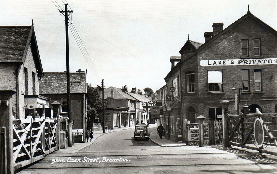
Lovely picture showing the crossing at Caen Street Braunton possibly in the 1930s. The building at right still exists and can be seen on the modern Google Streets view above. Source: PicClick.
When I first encountered this part of the line more than forty years ago the station was still almost fully complete along with gates and signal box (just as those at Wrafton and Barnstaple Town were too.) It was the track that was missing, having been taken up five years previously and I am sure many other people who visited North Devon in those days were quite bemused seeing an entire disused railway station being practically a towns primary focal point!
Certainly one could in those days easily find disused stations elsewhere among many miles of derelict railway stretching across the countryside – but one that was right in the centre of a town complete with crossing gates and signals too – well that was a rarity! Its a likely reason why many have shown interest in this particular line – for they do remember the three stations (Barnstaple Town, Wrafton, Braunton and Mortehoe) in this rather unfortunate state.
Continues in part two: Braunton to Willingcott.