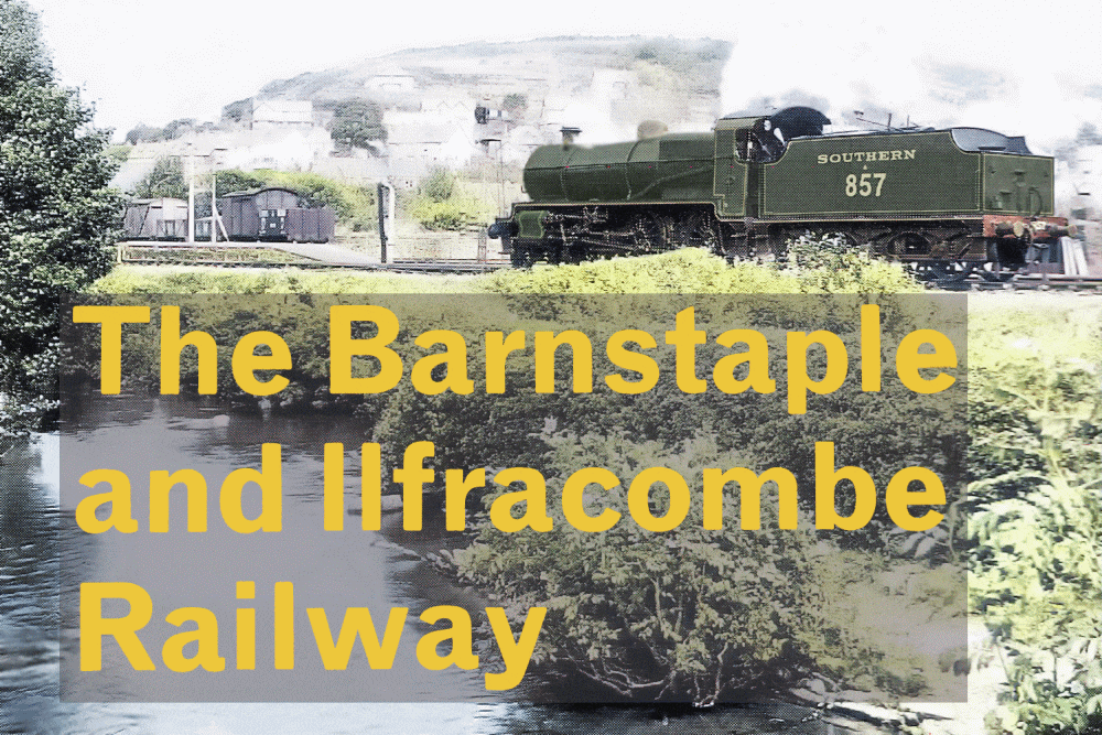
North Buckland Hill (Heddon Mill crossing) with the rails still in the road. The crossing keepers cabin is now an extension of the modern bungalow. Source: Google Streets
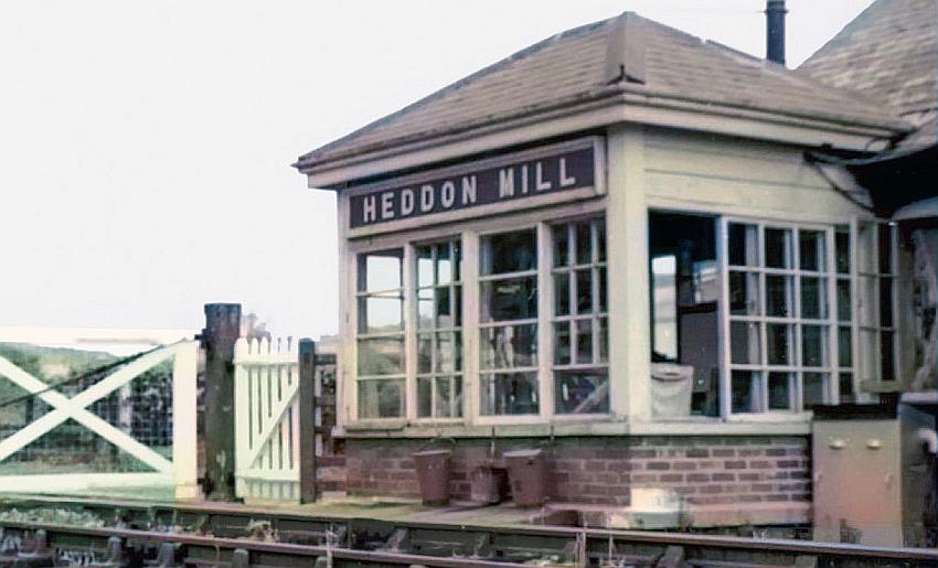
Heddon Mill in its final years as an operational railway crossing.
The course of the line can be seen on the right south of Spreacombe bridge. Source: Google Streets
Part of the railway bridge parapet at Spreacombe remains – as this Google Streets scene shows – its not a great image though and its why I haven’t included it here.
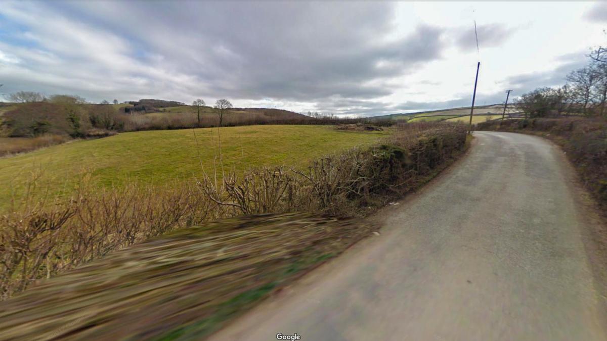
North of Spreacombe bridge – the railway alignment no longer exists it passed across this valley and the land has now been levelled although a bit of the line’s course can be seen in the distance at left. The line passed from right to left going towards Ilfracombe. Source: Google Streets
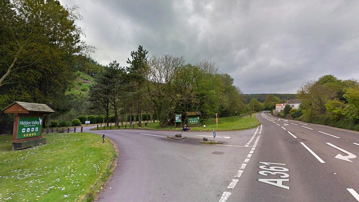
The A361’s Hidden Valley intersection – the railway passed just behind the trees on the left where the minor road leading to the Hidden Valley development is. The line continued to climb by way of utilising the valley sides to facilitate part of the ascent towards Willingcott. Source: Google Streets
The railway passes through quite narrow valley by the Foxhunters Inn. In fact this section of line from Buttercombe to Spreacombe bridge was proposed for a trail to complement the other sections of the Tarka Trail. An application was put forward to North Devon Council for the new trail. There were concerns about it but the council however gave it conditional approval. I don’t know what has happened since. A document relating to the proposal can be seen here.
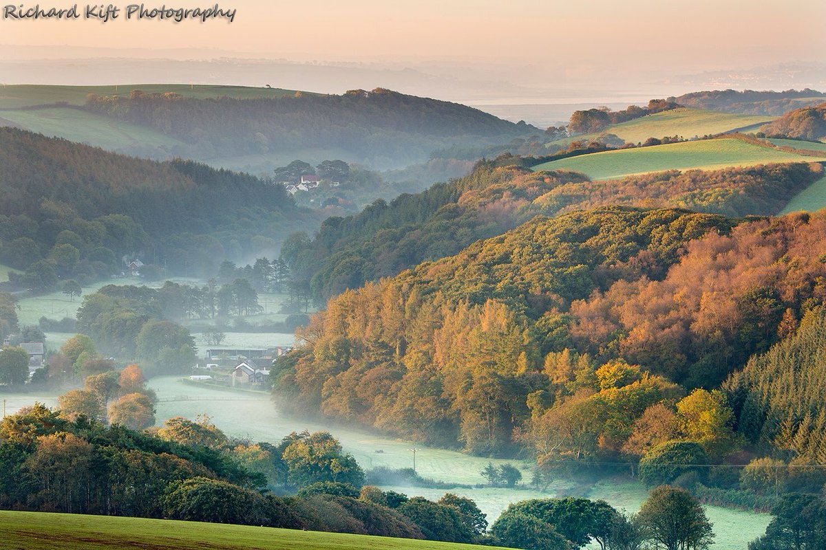
A pretty picture one might think however it shows the steep sided valley the Ilfracombe line had to climb. The location the scene is photographed from is probably near hereabouts on Google Streets. The house in the distance at centre left is where Stoney Bridge crossing is located. The Taw estuary is in the far distance. Here’s Google Streets showing that very house by the former Stoney Bridge crossing. Source: Twitter
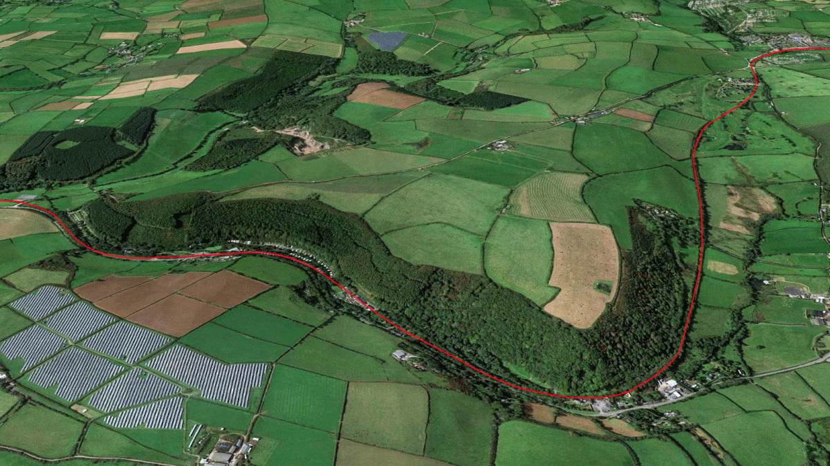
Aerial of the route between Spreacombe bridge (at left) passing through the narrow Caen valley towards the Foxhunters Inn, then westward through Buttercombe, Willingcott and Mortehoe (at top right.) The Hidden Valley development is midway between Spreacombe and the Fox Hunters Inn, the latter being sited where both the A361 and railway separate to go their different ways.
Its not really a common sight in England to see a main line railway climb up the sides of a valley towards a watershed, top that watershed and then drop down into the next valley. Usually it would be achieved by way of a tunnel or a very deep cutting but this is in fact what the Barnstaple and Ilfracombe railway did and even though there was a cutting at Willingcott bridge the line continued to climb beyond that. In just one and half miles the line climbed over two hundred feet in elevation!
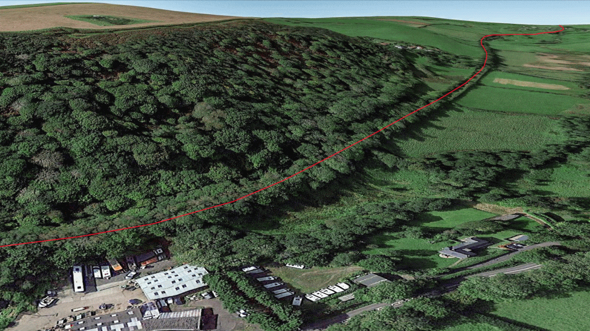
View from the Foxhunters petrol station and garage (bottom left) to Willingcott showing how the terrain forced the line to ascend steeply before practically climbing over the top of the hill – that’s something so rare in the UK even among the main line railways! Usually this sort of thing entailed a cutting or a tunnel. Willingcott bridge is right at the top. The A361 can just be seen along the bottom of the picture.
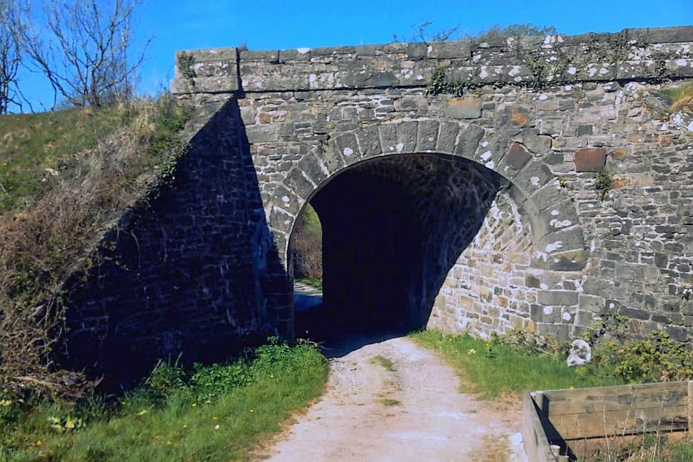
The one bridge on this steeply graded section was near Buttercombe Barton and this is it. This is where the proposed trail southward to Spreacombe will begin. Source: You Tube
The stretch of railway towards Willingcott was redeveloped in the 1980s to become a golf course with a few buildings converted to holiday use. This entailed the levelling of a substantial section of railway embankment to the south. The venue went broke a few years ago but in the meantime a holiday village had been developed around the west side of the site – and then proposals for a new and larger development consisting of 107 houses on the former golf course site were mooted, causing concern among locals due to the size of the proposed works and the fact the site borders an area of outstanding natural beauty.

The Willingcott Valley Holiday development. The railway ran on the left and part of that alignment is now an estate road. Source: Twitter
The line’s final level crossing was more or less in the middle of the holiday development. Today there’s barely any trace of that crossing (which served a farm track.) In terms of the Tarka Trail North Devon Council have plans for a walking route through the holiday village which would link up with that proposed further south to Spreacombe as well as link up with the existing Tarka Trail north to Ilfracombe.
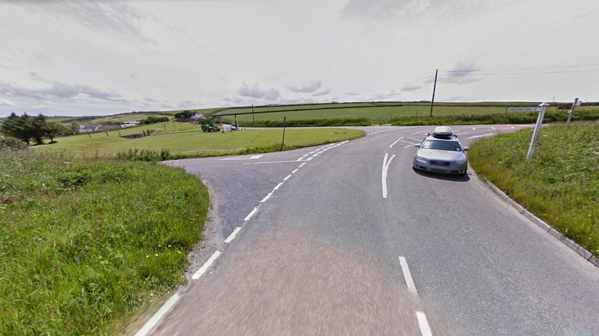
The site of Willingcott bridge was just behind the car seen here. The valley leading towards the Foxhunters Inn some two hundred and fifty feet lower down is at left. To the right the railway climbed up more in order to reach the station at Mortehoe. Just off the picture at right the detached northern section of the Tarka Trail begins and this heads towards Mortehoe and Ilfracombe. Source: Google Streets
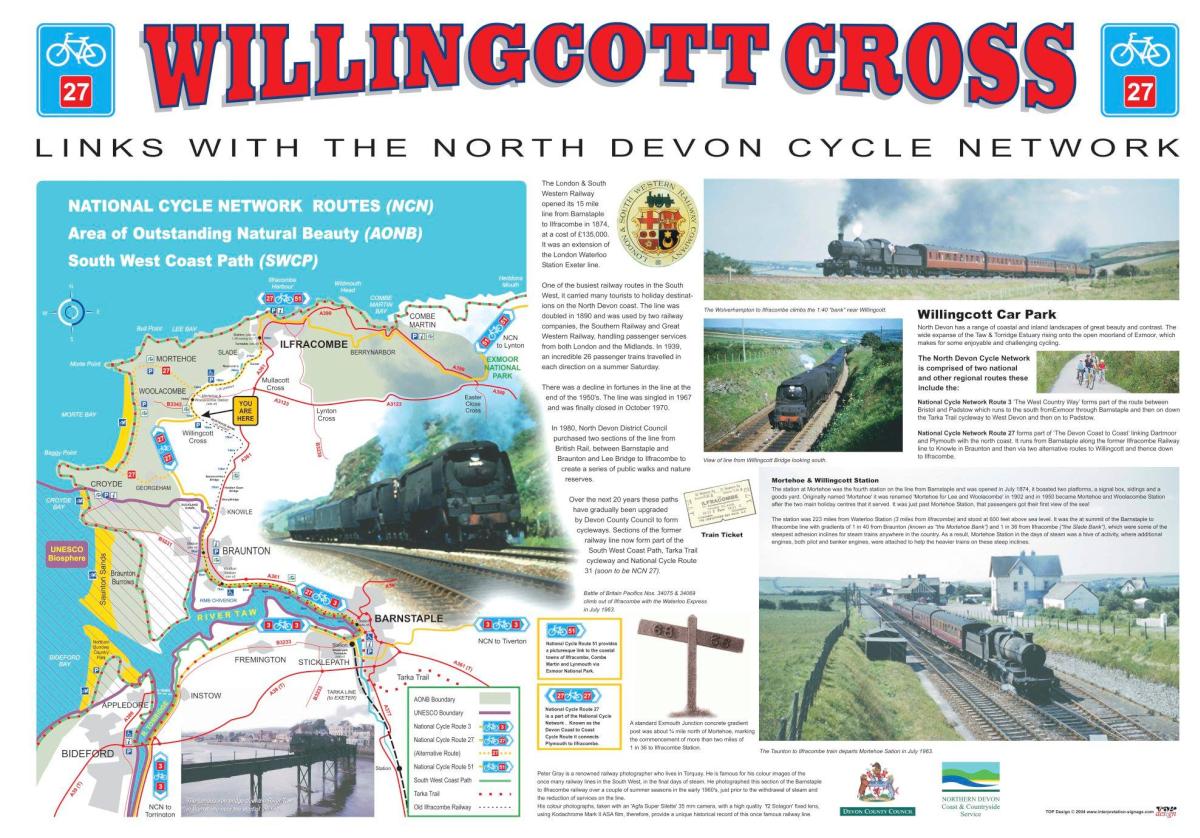
There was a information board at Willingcott Cross. I don’t know if its still there however here’s this image of the board as it was produced in 2004. Source: Coombe Rail.
As mentioned earlier the railway continued to climb beyond Willingcott bridge – and the route eventually came to Mortehoe which was the next station on the line. This was where one would alight for a number of popular locations nearby including Woollacombe, Croyde and Lee. Indeed in the line’s early days the station advertised itself as being the stop where one would get off for those popular seaside places.
Continues in part three: Mortehoe to Ilfracombe.