Again & again it’s been said Crossrail should have a City Airport station. This week the news is City Airport’s in discussion with TfL on it. Crossrail actually passes through the site of the old Silvertown station on the North London Line and this was once City Airport’s official station! The argument for a new station has been going on for years with City Airport even drawing up proposals and offering to put up a considerable sum of money to get a station built and all three sides (Crossrail, TfL and City Airport) have objected to the idea at various stages.
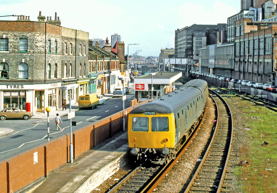
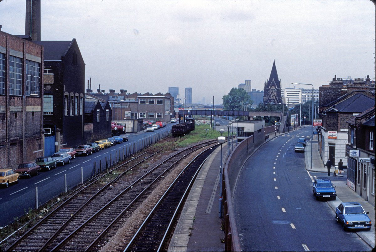
The old City Airport station – aka Silvertown – on the North London line. View taken in 1985 before electric services began. Source: Twitter (Note: Tweet has been deleted thus an archived image is used.)
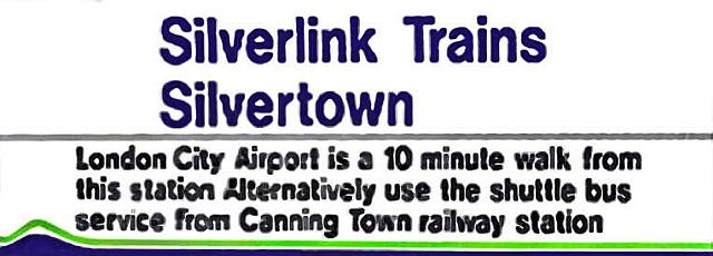
The old station nameboard resurrected! As the image shows it was a ten minute walk to City Airport. (Its probably five if one knows the short cuts in the area.) In later years the station name signs did actually have ‘City Airport’ added to emphasise it was the alighting point for this airport.
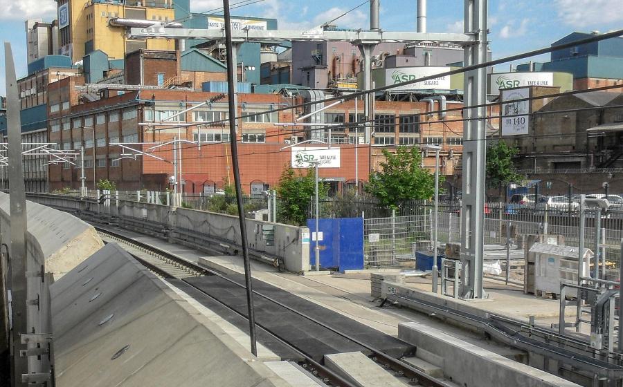
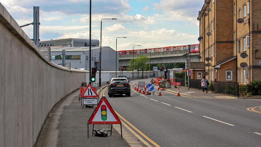
The current site which now carries the Elizabeth Line’s tracks. The walls are very thick perhaps two feet, with retaining sections every so often for the cantenary masts. This means the walls have to be set out quite a way from the tracks, and this alone is a huge problem in putting anything more than just a basic pair of tracks into this very limited space.
The walls here are mostly perfunctory, forming a barrier and also support for the OHLE. Flood protection here is at best rudimentary and clearly relies on the section further east to mitigate the effects of any floods.
1983 view of the old Silvertown station, clearly showing the very constricted nature of the passenger facilities. Even if two tracks and a pair of platforms or an island platform were used it would likely be a H&S nightmare with very narrow platforms – and where would those legally required accessible lifts and ramps go? Source: Twitter
One of the biggest and most intriguing aspects of this issue is Crossrail actually passes underneath City Airport itself, its tracks pass directly beneath the main runway! From the Woolwich direction the line runs parallel to the airport itself before sweeping in an arc round the west side of the airport’s perimeter right beneath a plane parking lot and then directly underneath the western runway approaches.
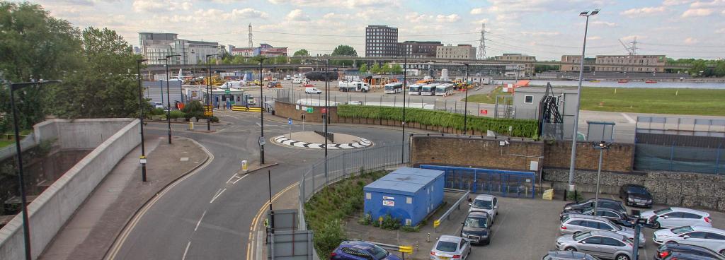
View from the furthest possible extremity of the station site towards the Connaught tunnel and the Docklands railway viaduct. Crossrail sweeps round to the north to go under the airport itself. The DLR train seen in the picture has just left City Airport station.
That bit under the airport itself is the Connaught (or Silvertown) tunnel – a very old construction dating from mid-Victorian times that has recently been renewed completely in readiness for Crossrail. However the approaches to this tunnel are in the open and the old Silvertown station was right at the start of the slope leading down to the tunnel itself.
Crossrail’s at extreme left where its about to dive under the airport by way of Connaught tunnel. On the far side of the road is City Airport’s Jet Centre.
Why cannot a station be built here? Its a good question. I’m no engineer so my opinion on this shouldn’t really count, its just an analysis based on what I know. But there is one issue and that is Crossrail would actually require more land than the North London line had needed. There were once three tracks along here so there was sufficient space for a pair of Crossrail tracks, associated infrastructure, the huge flood barrier walls, the catenary masts and so on. But there isnt really enough for a big station despite a considerable parcel of land at the western extremity of the site which once formed a junction with the long gone Silvertown tramway.
Plans drawn up in 2014 shows a station at Silvertown would most definitely need a considerable amount of land, far more than is even available. Remember the Crossrail (Elizabeth Line) trains are extremely long (205m) thus lengthy platforms would be needed and when once takes into consideration the widths, the space needed is enormous.
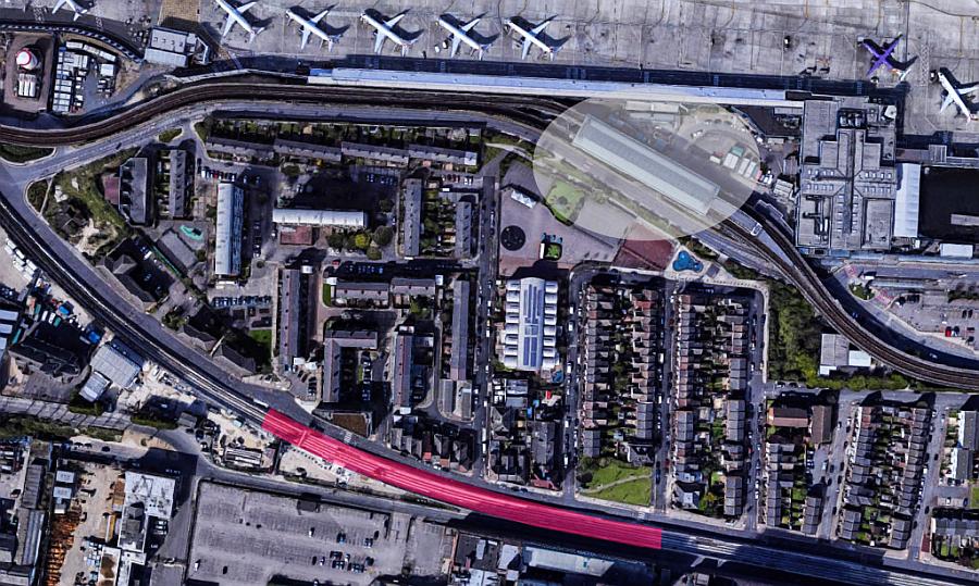
The red area highlights the absolute minimum extent a Crossrail station would need for its 205 metre long trains. Its not enough though because that excludes much of the platforms infrastructure, station buildings and platform over-runs, not forgetting the need for access, subways, stairs, ramps accessible lifts etc. The lighter shaded area denotes the Dockland railway’s City Airport station. (Map I created based on Google Streets.)
Its a designer’s nightmare to try and fit a station into such a constricted space. If they move the station any further west the tracks begin descending sharply and that is because the railway goes into the cutting leading to the Connaught tunnel itself. Of course there’s no space in that brick lined cutting either, not even for a sliver of a platform!

View of the western end of the station site where the tracks immediately descend towards the Connaught tunnel. The DLR’s viaduct can just be seen in the top right hand corner. Source: Wikipedia
Update: One of the other issues with any station hereabouts (or further east) is as John pointed out in the comments, any new station must have straight platforms. Nowhere is there any absolutely straight sections and there’s even a hump in the tracks further east to create a flood barrier protection. These factors mean it would be very difficult without major re-alignment and levelling plus I assume new flood protection measures if any station was to be built anywhere between the ramps to both the Connaught and Thames tunnels.
How close is Crossrail to the present City Airport station?
The sticking point about all this is the fact Crossrail/Elizabeth Line trains will be passing the airport and people there will be able to see these trains dashing through the vicinity – but frustratingly wont even be able to use those services!
What it means is one would have to take either of two options. One is to go to Canning Town on the DLR and then back to Custom House to get the Elizabeth Line. The other is to get a bus direct to Custom house.
In the earlier photographs I took one could see just how near the Crossrail route is to the Docklands Light Railway’s tracks and of course very near the airport itself.
Let’s have a quick look at how near the Elizabeth line actually is to City Airport and the Docklands railway station….
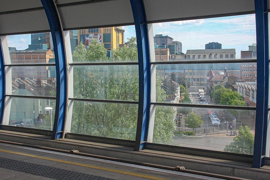
From the Docklands’ City Airport station one certainly can see Crossrail/Elizabeth line’s tracks at the bottom of the adjacent roads. The huge Crossrail wall can be seen at the bottom of Wythes Road.
The distance from the airport terminals to Crossrail/Elizabeth line is approximately 231 metres (760 ft.) From the centre line of the DLR platform its just 217 metres (714 ft.) These distances are almost the same as another controversial Crossrail/Elizabeth line on street interchange – Oxford Circus. From the Crossrail entrance in Hannover Square to the nearest entrance that serves Oxford Circus tube station its just 231 metres (760 ft) walking distance.
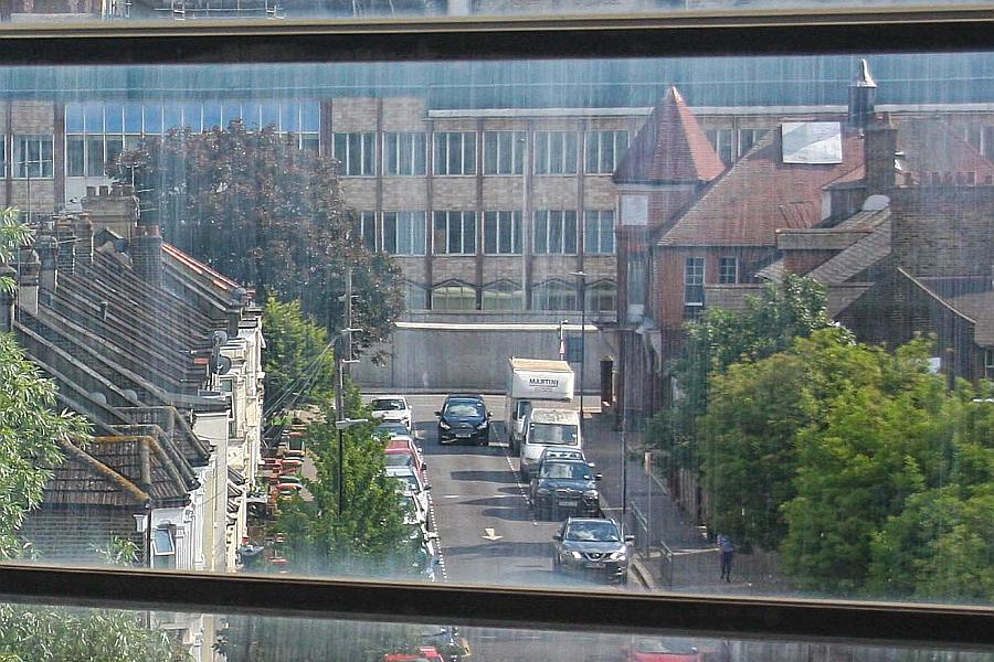
If we zoom in, Crossrail’s massive flood wall can be seen. The end of this short bit of road (Wythes Road) would be how far away from the airport a new station would be. Note the building with its pointed roof…
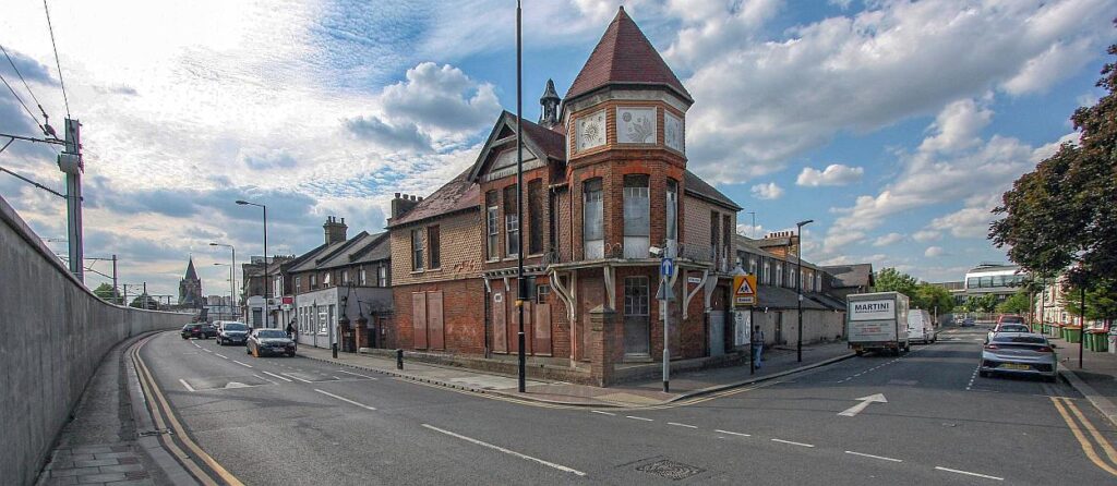
The building with the pointed roof again! Its a historic structure but not currently in use. Anyway, down the road (at right) can be seen the present City Airport station, and on the left Crossrail with its wall and cantenary masts clearly visible. This is the site at which most think a new station should be built. Land is a huge problem however as it is anywhere along this section of Crossrail. Evidently one knows what the answer would be. Much of the area would go the same way as that around the Astoria and the top end of Charing Cross Road.
6 responses to “Build Crossrail’s City Airport station!”
The technical standards to which new railways now have to be built require platform edges to be straight, in order to minimise horizontal and/or vertical gaps between trains and platforms, for reasons of safety and accessibility. This effectively rules out a new station on a curved stretch of line.
Yes you are right. This means even the straighter section further east isn’t actually straight enough and would have to be altered! Plus it has a hump which means uneven platform heights.
Could you provide a link to the report from which the maps and images come?
Thanks,
Abe
Please re-read the post. There are some updates and additional notes that have been added to cast more light on the situation. Another image showing the proposed Silvertown and a report briefly discussing the costs a new station and the effect a prolonged closure of Crossrail would have were also found and these are included.
Last year TfL did do a bit of work looking at the strategic wider benefits of a Crossrail station in this location specifically around unlocking housing. The conclusion was there would be limited benefit until the Tate&Lyle site was redeveloped. Without it, a Crossrail station would have a very limited catchment but redeveloping the Tate&Lyle site would go against a whole raft of GLA/Local planning policies.
You missed one milestone – 2018
London City Airport names ex Crossrail boss Rob Holden as new chairman
https://www.standard.co.uk/business/london-city-airport-names-ex-crossrail-boss-rob-holden-as-new-chairman-a3993796.html