
The railway tunnel at Sapperton is no doubt famous and modern sleek Class 800s IETs from Paddington to Gloucestershire pass through it daily. There’s a much bigger tunnel through the same hills yet its popularity and awareness depends on where one is coming from. Even in the days before the railways arrived in the Golden Valley, that other tunnel, despite being the longest in the world at the time, was still little known.
Indeed it was, according to popular literature, the source of the River Thames! How on earth that conclusion could have been reached, one does not know! Evidently Google wasn’t around to help the writers of that day and age make sure their facts were spot on! As it stands the source of the Thames was nearer the other end of the tunnel. That’s well over two miles away! Or if one were to truly pursue the tributaries and how far these went, the source of the Thames was some distance to the north at Severn Springs near Cheltenham, besides other possible locations. Again, it depended on what one thought and believed – and in that case, well, Google might have not been of any help after all!
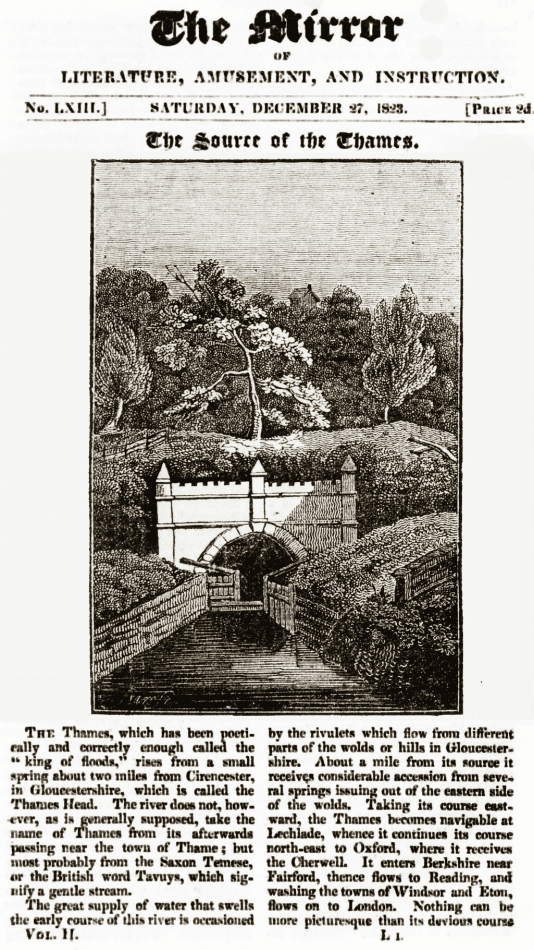
The Mirror of Literature, Amusement and Instruction, 1823 claims a canal tunnel as the source of the Thames. Its a rare picture showing a lock at the portal. Internet Archive.
Maybe someone had claimed the picture was of the actual Thames Head itself – and the Mirror’s writers took it to heart? Sure enough, the Thames and Severn canal ran right past Thames Head – there was in fact a pumping station sited here that raised much needed water for the canal. But still, two plus two doesn’t always make four!
If one wanted to, they could take it further and claim the Thames never actually begins at any of those places – or anywhere even. Rather it began in the clouds high up in the skies – and before that it began in other waterways, rivers, lakes, meres, even the sea. And a process of evaporation had sucked the water molecules up into the atmosphere to begin its downward journey as rain and ultimately to become a stream, river, canal, lake, and whatever before returning to the sea and starting the process all over again. As Heraclitus said, “a man cannot step into the same river twice, because it is not the same river, and he is not the same man.” But humans being humans, a limit certainly needs to be put on how far back something can be defined, otherwise one might be arguing about the origin of the Thames right back to the beginning of time!
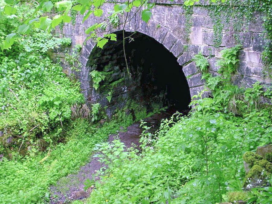
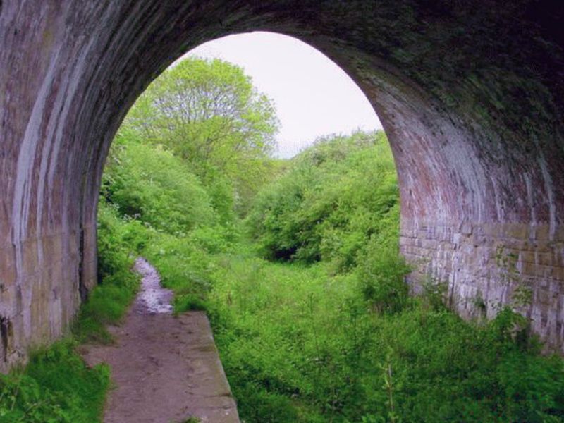
Daneway portal of the 3,817 yards (3,490 m) Sapperton canal tunnel in 2002. Photo by the author.
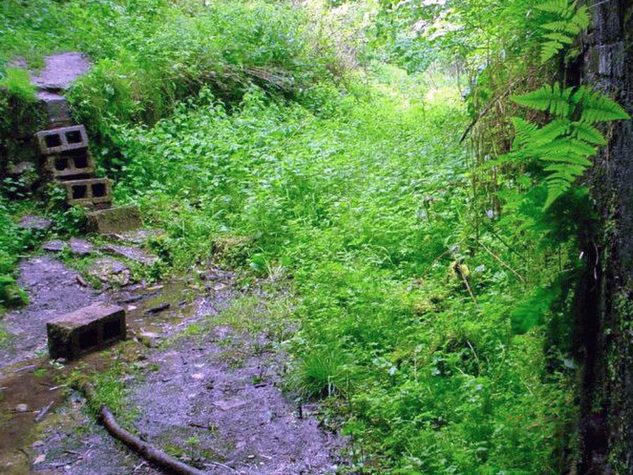
View from just inside the Daneway portal. The pile of breeze blocks would have been about where the gates were. 2002 photo by the author.
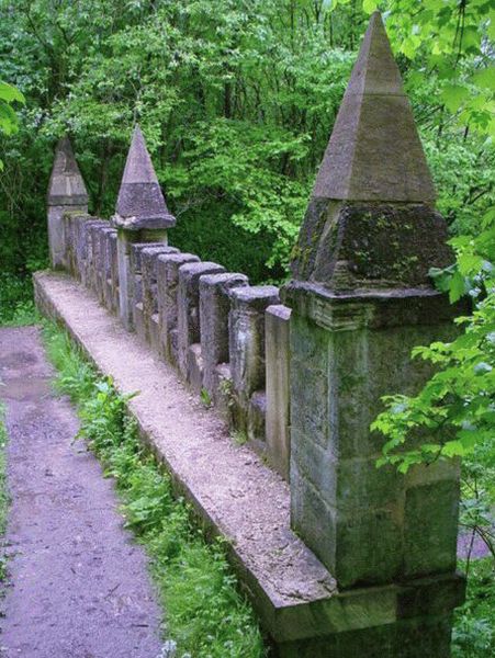
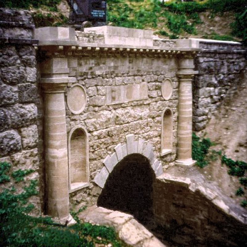
The castellated structure atop the tunnel portal. Photo by the author
Evidently Daneway isn’t the source of the Thames by a long shot! If anything, its one of the sources of the tributaries that leads into the Severn and that’s the River Frome. What there was without a doubt was an attempt to prevent water freely passing from the Frome catchment to the Thames catchment by way of the Sapperton canal Tunnel, two and quarter miles long – this was originally achieved by a lock gate much in the style of a couple of other canal tunnels.
The use of lock gates had to be done otherwise, there would be no water for boats heading towards the Thames and London – and because the other bit of the Thames and Seven canal beyond Coates, was, well, like a sieve! Instead of keeping a head full of water it would often empty itself particularly through a stretch known as Whitworth’s ‘rocky bad ground’. Whitworth was of course the canal’s original surveyor and he wasn’t happy with the geological conditions the new waterway would have to pass through. Nevertheless the canal builders persevered and it went through this ‘bad rocky ground’. The amount of water lost amounted to as much as three million gallons a day – a constant headache trying to ensure the Thames barges could stay float.
The railway bridge just past Coates. Whitworth’s ‘bad rocky ground’ extended from near Coates towards Thames Head. A stretch of canal that’s almost completely empty at all times. Author photo.
Even if Daneway had in any sense been the source of the Thames, never in a million years would the geological conditions have allowed water to pass to the east. The Thames and Severn Canal company tried and they failed and no matter what, whether it was nature or man, water wasn’t going from Daneway to London in any hurry!
The Thames and Severn canal, no doubt intended as an important route of commerce between the Severn in the west country and London, could never really fulfil its potential. It was a waterway that was, in terms of a through route, either open or closed for most of its working life. There just wasn’t enough darned water to keep the boats afloat! Even when it had closed for good in 1893, Gloucestershire Country Council and others formed a trust to restore and maintain the canal in order to give local trade a boost.
Even that too failed, for the vast Sapperton canal tunnel became impossible to pass. The last boats had struggled through in 1911 and the first of a number of collapses occurred in 1916. Gloucestershire council gave up the ghost in 1927. Even Brimscombe Port, some fourteen miles inland, could no longer claim to be a port. From the 1930s onwards the furthest east one could take a Trow up the Stroudwater and a short remaining bit of the Thames and Severn receded until the final bit of waterway shut for good in 1941. The lot was then legally abandoned.
Coates portal, Thames and Severn canal. August 1977. This was about three weeks after the restored tunnel structure was officially unveiled. Photo by the author.
Since the late 1960s, egged on by successful waterway schemes as the Southern Stratford canal, there has been an opinion that the combined Stroudwater/Thames & Severn route could be reopened once again. The Coates portal of the vast Sapperton tunnel was restored and re-opened in July 1977. A film of the opening celebration can be seen on Youtube – and the blue crane just visible at the top of the picture above can be fully seen in that video.
The Thames and Severn canal route is a vastly difficult and huge technological challenge. The lower stretches eg Stroud and below towards the Severn and South Cerney towards the Thames have seen some success in terms of canal rebuild and restoration. Further up, well roads have been built on the former canal. Bridges and embankments are missing, lengthy flights of locks have disappeared and even the canal’s two aqueducts no longer exist.
And that’s even before work gets to either Coates, Daneway or the tunnel itself! I do remember canal experts at the time, this being the early 1970s, looking at the notion of restoring the Thames and Severn and thinking, well it can’t be done. Those of us who paid visits and were pleasantly surprised by the restorations at Bowbridge Lock and Coates portal in the mid 1970s and of course we visited most parts of the route, sometimes, by car, sometimes by organising coach trips. I subscribed to the society’s magazine The Trow (and still have the entire collection from the 1970s and 1980s) plus some thirty years later walked a good bit of the Thames and Severn in order to see how far restoration had progressed.
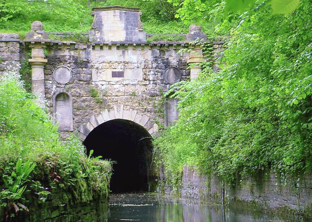
The portal at Coates. Daneway is two & quarter miles distant via the tunnel. Photo by the author. 2002.
In terms of restoration however, the Sapperton tunnel is no doubt going to be a major problem because it has collapsed in a quite a few places. The geology isn’t superb at a number of locations although that is countered by being superior in other parts of the tunnel where the bore is completely unlined. There’s a report on the tunnel’s condition. There are numerous other obstructions too but as recent events have shown there has been success at Ocean Bridge and Wallbridge – no doubt the impossible can be achieved.
Kudos must of course be given to the Cotswolds Canals Trust (the former Stroudwater, Thames and Severn Canal Trust) for having the determination and vision to ensure a waterway route of around forty miles in length is reopened between the Severn at Framilode/Saul and Stonehouse, Stroud, Brimscombe, Siddington, South Cerney, Latton, Kempsford before reaching the Thames at Inglesham.
Sites worth visiting:
Cotswold Canals Trust.
Cotswold Canals in Pictures.
Main image from one found on Ebay and ‘Daneway’ text from an old map of the 1890s.
Leave a Reply