The railway’s route from Southwold to Halesworth:
From the station itself the line headed across Southwold common and soon entered the largest cutting on the entire route. This present day view on Google Street shows the start of the cutting itself. Its been a public footpath for the last seventy years or so. This footpath was what enabled me to begin my explorations of the old railway line from 1970 onwards.
The cutting on Southwold Common seen from the footbridge built in 1902.
As the line traversed Southwold Common it gradually fell towards the River Blyth and soon the junction for the Southwold harbour branch was passed. Almost straightaway the line crossed the River Blyth by means of a twin span bridge, one of which was a swing bridge. The need for this swing bridge was because the River Blyth was navigable to Halesworth. The navigation was sporadically used just a few years after the railway was built and ceased altogether in 1911.
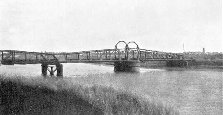
The bridge over the Blyth near Southwold. The right hand span was blown up by the army in 1942. Source: Twitter.
The next station, Walberswick, was nearly a mile from its namesake, and consisted of a simple affair. There wasn’t even a proper road to the station in those days. However complaints soon ensured the railway put in a bigger station building – no doubt to give the passengers more comfort at this isolated spot!
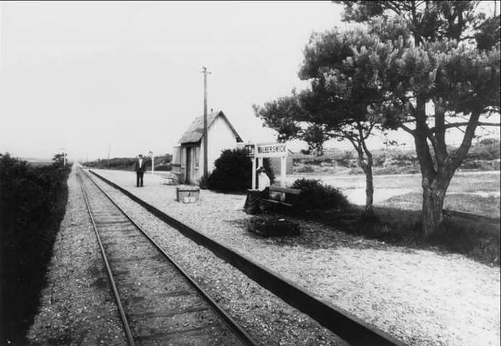
Walberswick station looking towards Southwold. Source: Twitter.
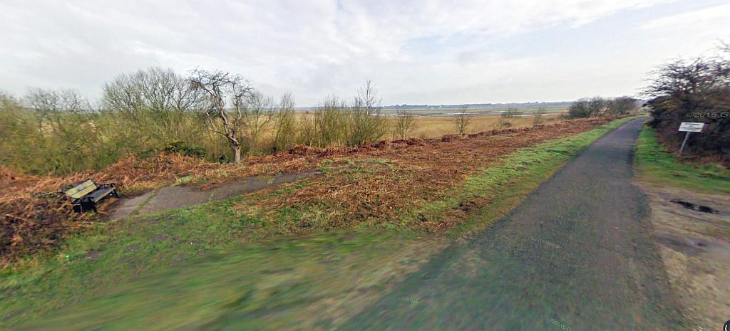
Present day view of Walberswick station. This is actually a view to the rear of the station. The seat marks roughly where the station building was. The former railway alignment can be seen in a straight alignment from left to right. The lane the photograph is taken from can just be seen in the old picture. Source: Google Streets
After Walberswick the line ascended towards the Heronry. It is popularly said the line wasn’t much in terms of gradients or scenery however the railway cut across the land rather than follow the course of the river and it meant substantial gradients were necessary.
The line used cuttings and embankments to navigate this part of the route through the woodlands and even managed a minor overbridge! The following pictures show the section through the woods was quite spectacular, the line itself having gained a considerable elevation away from the Blyth estuary.

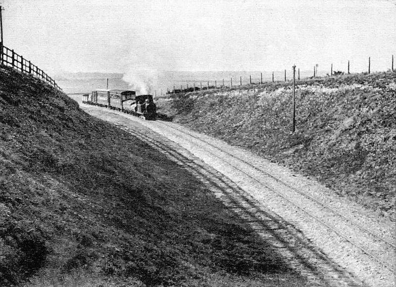
A train for Southwold about to enter Blythburgh Woods (otherwise known as the Heronry or Hill Covert.) The Blyth estuary can be seen in the background. Source: Facebook.
In the next picture it can be seen how the line climbs through the Heronry woods towards Blythburgh, the substantial gradient to the rear of the train can be seen quite well.
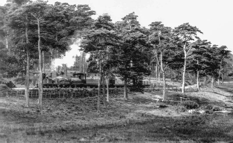
Most publications show a somewhat cropped version of this view of the line through the Heronry, however this in my collection is clearly a wider shot and this shows the gradients hereabouts to good effect. The train is bound for Southwold, sometime between 1909 and 1914 and the engine is no.3 Blyth.
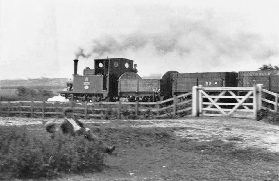
The railway approaching Blythburgh. I think this is the bit that passes behind the White Hart Inn. Notice the locomotive’s crew leaning out of their cab, curious as to what the photographer – or these two men – are doing! Source: Twitter.
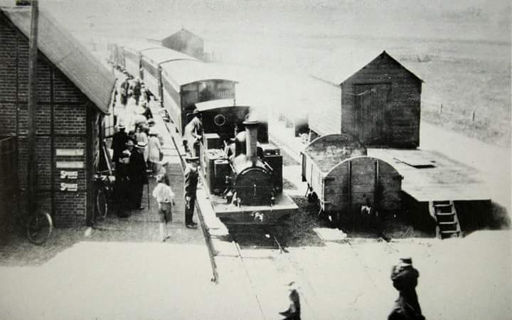
Besides Southwold and Halesworth, the only other station of substantial importance was Blythburgh which had a passing loop and a goods yard. The passing loop was quite new in terms of the railway’s age, it was installed in 1908 previously there was just a siding here. This was also where the line tokens for the Halesworth – Blythburgh – Southwold sections were exchanged.
A view of Blythburgh station from from the A12 road bridge. The goods shed building in the distance still exists! Source: Twitter.
The same view today as seen from road level. The bridge was removed in 1961 and the gap filled in to provide a continuous embankment. However that too was levelled in order to make the road wider and the approaches more safer.
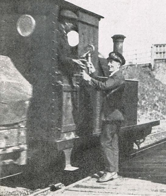
Exchanging the line tokens at Blythburgh. The larger one for the Blythburgh to Southwold section can seen in the station master’s hands. This consisted too of the keys for accessing the railway’s harbour branch. This token is now in the Southwold museum. In the background can be seen part of the bridge that carried the A12 road from London to Norfolk.

Another view of Blythburgh station in 1909, this time from the main London A12 road. The huge church can be seen. Source: Wikipedia.
Blythburgh church is a pretty substantial building full of history. It stands on a hillside overlooking the estuary and because of its imposing presence is known as The Cathedral of the Marshes.