A quick post on the latest involving the Llangollen canal at Whitchurch especially after a comment that was posted on this blog. Yesterday several including Taylors and Court Above the Cut attended a tour of the breach site conducted by CRT’s Project Manager. At the point where they went down to the entrance to the culvert (which so many have been discussing) attention was being made upon a brick wall or structure situated somewhat above the culvert entrance at a level that seemed a bit of a mystery. Even CRT said they didn’t know what it was for.
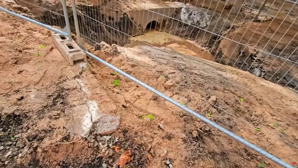
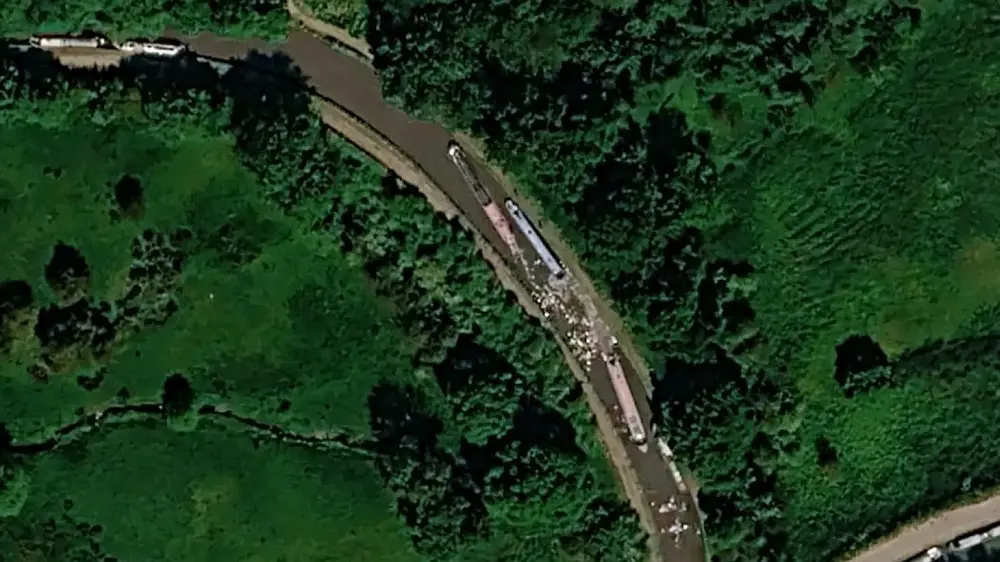
Part of a brick wall can be seen on the left just below the fence. The second culvert can be seen in the background. Screencap from Youtube.
The answer to that mysterious brick structure might been due to the fact some sort of structure had been established hereabouts since perhaps when the canal had first existed and somehow linked to the mill at this location. This is evident from maps between 1835 and 1845. That date range is given because the Birmingham and Liverpool Junction Canal (opened 1835) is shown on the same maps. That name lasted a mere decade or so before it and the Ellesmere canal became part of the Shropshire Union Canals. Hence the mysterious brick structure could possibly have formed part of this structure and was later reused for some other purpose, including an early road, for tarmac was mentioned too. Whether that was the much older macadam or the more modern tarmac isn’t known, but either of those would have given some indication of the age of the mystery brick structure in question.
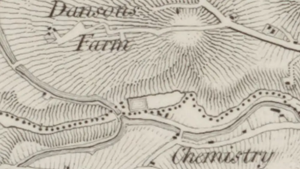
OS Old Series 1800s to 1860s showing the Ellesmere canal and a dam or other structure where the bricks might have originated. The area’s original thalweg would have probably gone through the centre of the above arrangement between where the streams split and then re-merged to go beneath the canal. National Library of Scotland.
The mysterious second culvert (Culvert 34) was no doubt the one and only, original, to be built at the time the canal was constructed. So we know from the map above that this was the thalweg – the original valley bottom at that very juncture. And that is because the original boundary (as marked on the above map) had followed the very bottom of the valley – hence its thalweg. Over time the valley’s profile got changed and especially on the west side of the embankment it shifted more towards where the later man-made Staggs Brook (Culvert 35) is now sited.
See National Maps Scotland for that particular detail.
Someone by the name of Malte wrote a comment on London Rail yesterday and suggested the second culvert (as we all know it) was not to blame for the canal breach. That could well be true. One can also see my response to that comment on that page too. Malte said:
The secondary culvert, which was buried as a result of the breach, has now been completely uncovered, flushed out, and inspected using cameras. It remains fully intact and was not responsible for the canal breach. It is now once again being used for water drainage. May 13, 2026.
Malte’s comment was absolutely nothing new to me for I have been following the Whitchurch breach practically every day since 22nd December 2025 thanks to Kieran and Lottie and Riley Robey among others. And that is because my sheer and dedicated interest arises from the fact I have worked on the Llangollen canal and clearly remember the huge breach that occurred during the 1980s. Besides I’m a canal enthusiast too!
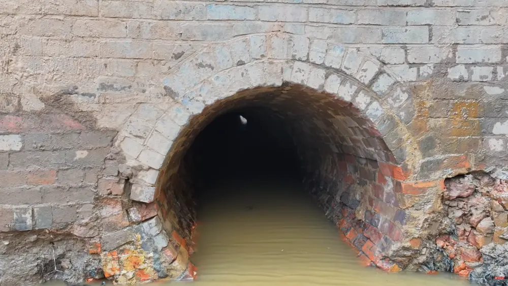
Scene through the culvert filmed from a drone! The culvert is on a curve which indicates it followed roughly the original watercourse. Screencap from Youtube.
No doubt the video looking through the culvert was of interest to many including myself – especially considering it was in far better condition than had been thought! The fact the mysterious culvert (which is no.34 according to CRT) isn’t quite so mysterious now has explained a few things. It however remains a mystery especially in light of what has been found since. There’s no doubt it had remained completely unknown and undetected for decades. Both Kieran and Riley Robey do mention that they and other locals do not remember a second culvert or stream at all, and that even though the area was well known to many.
Its clearly evident the second culvert had become completely forgotten – and over time it had ‘got lost’ by way of silting or erosion, whatever. Subsequent foliage had then largely obscured any traces of it. Practically nothing can be seen of it on Google or other aerial photos. The fact eight inch diameter pipes had been installed beneath the field on the other (west) side of the breach site and which subsequently got blocked shows there was simply no means for the water to flow in its proper thalweg and the area above to drain properly.
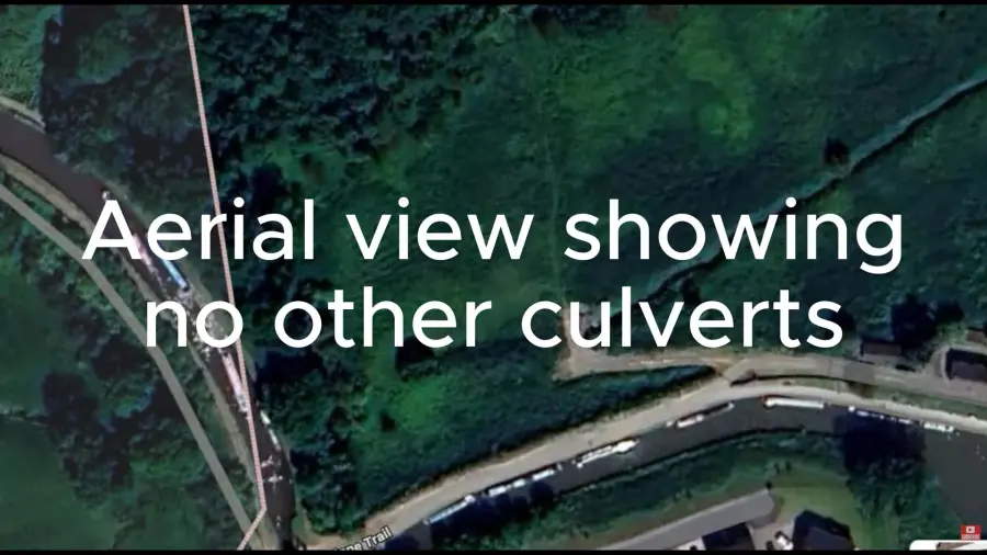
Youtubers saying no other culverts visible. Screencap from Youtube on 29th December 2025. London Rail had indicated on 23rd December 2025 there was another.
This last few days, especially after seeing how the culvert had been what seems to be absolutely perfect condition, and yet the eight inch diameter drainage pipes beyond had been compromised, silted up, even broken beyond use, shows us that prior to the breach the water was no longer using its natural valley profile. I think somehow this state of affairs had led to a compromise in the integrity of the canal embankment. CRT in their interim report (page 17-18) do say they suspect there was water working its way beneath the point where the embankment failed. They suggest the water was leakage coming from the canal above – but it could have been the water that was supposed to have gone through the culvert and because its progress had been blocked, it had found a new way through the embankment.
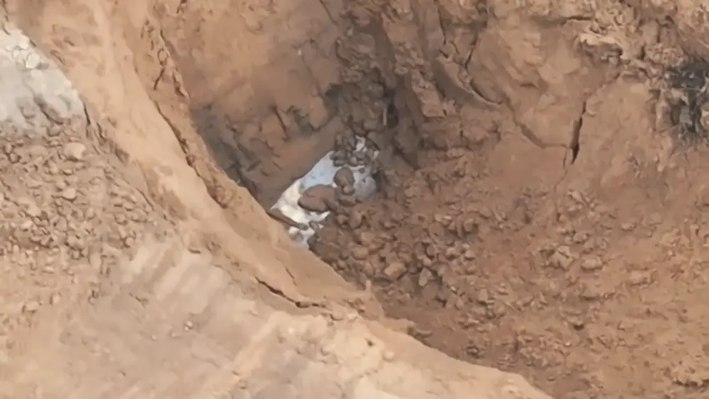
Looking at the Google aerial image fully in question it seems absolutely inconceivable a second culvert had even existed. But it was eventually found! The first positive indication of it was early April, for example on 10th April 2026 its location could be seen as a depression in the mud.
The fact the breach occurred on the east side of the embankment, this being the upstream side (the west or downstream side was left pretty much intact) was, at least to me, quite odd because in most cases a breach would occur on the downstream side of the embankment (as countless numbers of canal breaches have testified – including that on Bridgewater canal at Dunham (January 1st 2025), the one earlier this year on the Macclesfield canal at Boseley, plus those a few years ago on the Middlewich Branch and the Trent and Mersey at Dutton.) An upstream side breach is no doubt a rarer phenomenon simply because water doesn’t run uphill.
UPDATE 15.30pm: I just remembered instances where water had been found running below the vicinity of the breach. This screenshot from Kieran and Lottie at the start of April 2026 shows water running approximately in the direction I suggested it would have gone. This might have been from the pool that had formed above the site, however it certainly shows the water seemed to want a particular direction – eg underneath the canal embankment. A deep hole had been dug to see what the conditions were – and that revealed substantial water movement flowing AWAY from where Culvert 34 was sited. One can tell from the position of the stairs on the embankment this hole was dug about three meters to the south of where Culvert 34 would be discovered three weeks later. Screencap from Kieran and Lottie – Whitchurch Canal Breach Update, New Works Start, Busy Day On Site!
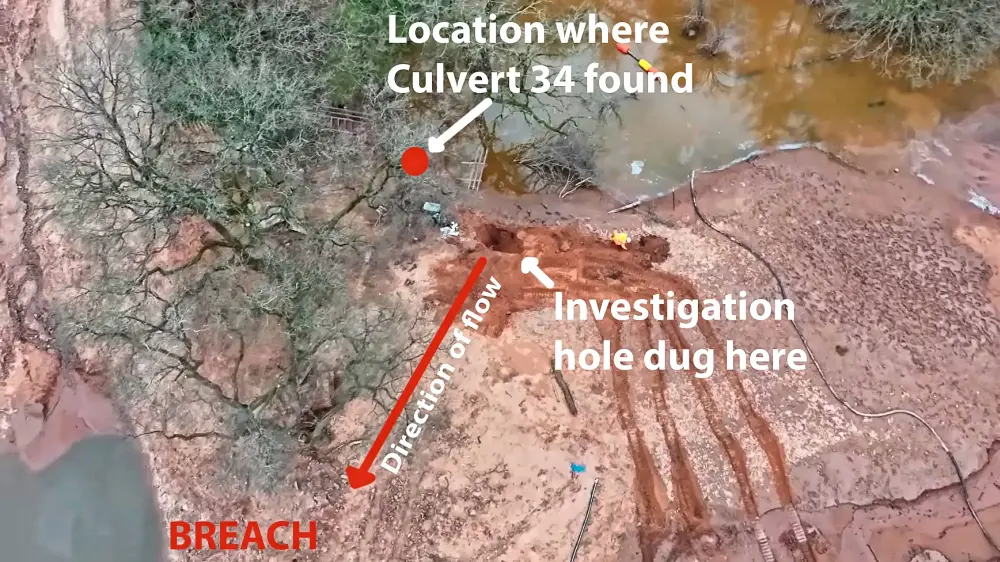
In retrospect of that screencap showing water flow towards the breach site, I quickly drew up this pictorial description to show where Culvert 34 was later to be found and the location of the hole that was dug – showing actual water flow and the direction it took which was toward the actual breach site itself. Obviously that was likely the only means the land could properly drain in lieu of culvert 34. Whether this state affairs had contributed to the breach is of course open to interpretation. The aerial is a screencap from the invaluable Kieran and Lottie on Youtube.
It seems to me this upstream breach may have in part resulted from what was a compromised drainage situation (this is the second culvert no.34 and the course the steam leading to it once went plus the piping that led away from it)which might have weakened the west side of the embankment, causing it to ultimately give way. Its possible given the geological dictates under which a thalweg is to be found, that the groundwater had shifted to a different position, which would be to the south of where the original thalweg was to be found. If one looks at the west side its evident the thalweg has shifted to the south, so any groundwater could well have shifted to a different location (in other words finding a different route in order to ‘conform’ with the newer, artificially induced west side thalweg), and that would have therefore passed under the embankment a handful of meters or so away, thus weakening it where the breach ultimately occurred. Of course there might be other factors too (as per CRT’s initial findings) that contributed to the calamitous breach of 22nd December 2025.
My observations are simply an interpretation of what might have possibly happened. In no way is it a conclusive engineering opinion of any sort.
Update: Just seen Court Above the Cut’s report on the site visit. Says the repaired section including concrete channel will be 100 metres long. It seems somehow insufficient given the quality of the embankment (which extends towards the by-pass) and the location of a possible third culvert. With a guess of sorts as to what additionally can be done, maybe they could line the canal with rubber sheeting for a further 100-200metres beyond the planned section? The only problem is that will bork any attempt to restore a water flow through the site by way of a flume/siphon.
Update 2: This scene from Kieran and Lottie/Riley Robey’s latest Youtube video just published 25 minutes or so ago at 14.00 on 14th May 2026, does give some further possible notion as to what happened in terms of the breach. Its clear from the scene how the valley is formed (eg its original thalweg and drainage function) and the most important route for that would have been where the second culvert (no.34) was. However because that culvert was quite likely blocked the roles were hence reversed on the opposite side (the Staggs Brook had become the main watercourse) which means groundwater had to diagonally pass beneath the embankment approximately where the breach occurred. Any water trying to pass beneath the embankment could have pooled to an extent and as a result caused a weakening of the earthen/sandy structure on its upstream side.
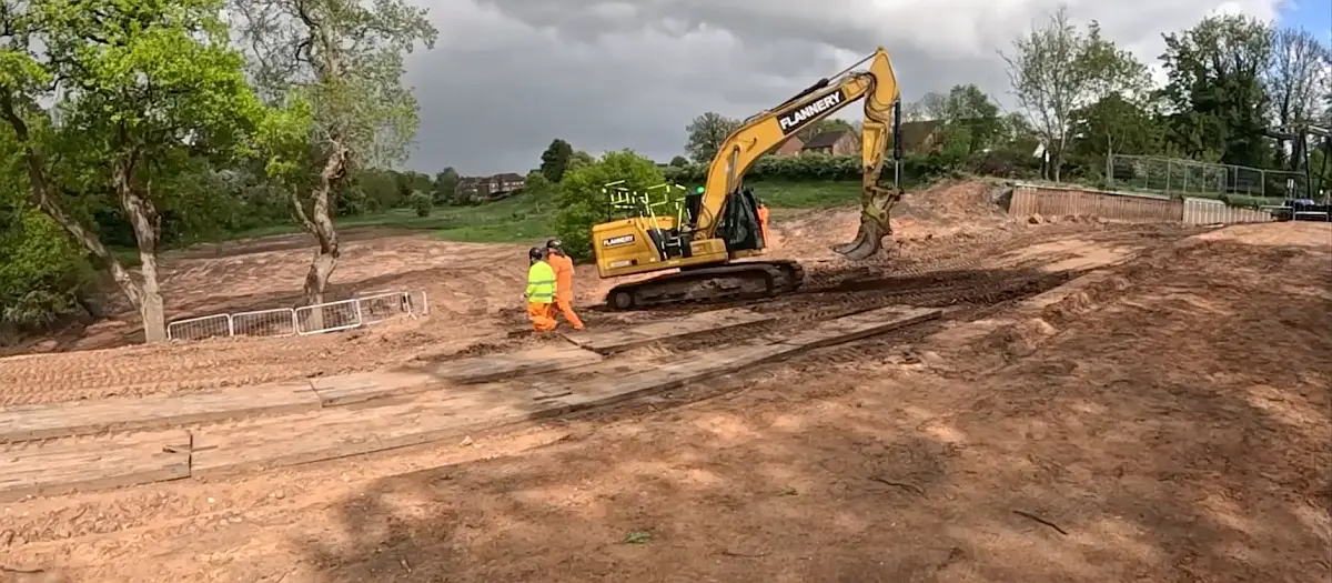
Scene from Kieran and Lottie/Riley Robey’s latest Youtube video – Whitchurch Canal Breach Update, Site Walk-Around & Close Up To The Works!
Leave a Reply