A tour featuring some of the highlights of the 440 mile electrified length of the Milwaukee Road between Harlowton and Avery and showing what exists these days mostly using Google Streets. This is a follow up to the introductory post I did a few days ago covering the history of the Chicago, Milwaukee, St, Paul and Pacific Railroad – especially its Rocky Mountain section which in 1915 was the world’s biggest rail electrification scheme.
This is divided into four sections – 1) Harlowton to Butte 2) Butte to Missoula 3) Missoula to Saltese 4) Dominion Creek to Avery. There was loads stuff I found on Google Streets however in the event I decided to do just a condensed tour mostly covering the main elements I found. It took me a good three days or so just tracing the former Milwaukee Road and locating its bridges, crossings, stations, etc – and that resulted in several hundred locations being recorded!
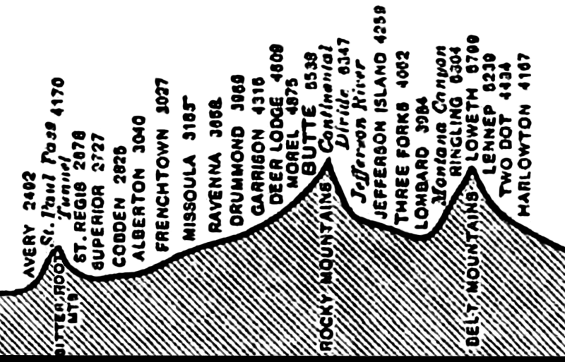
The summits and elevations of the main stopping points along the route.
The line’s first major summit at Loweth is just west of Harlowton – and this summit is why the electrification had to begin at Harlowton – because it was a major depot on the line with locomotive sheds and really the only place east of Loweth where substantial operations could be undertaken to prepare trains for the long and often arduous 440 mile trip ahead.
The other thing of interest is the distance as the crow flies between Harlowton and Avery is just 289 miles. The Milwaukee’s route adds almost an extra 150 miles to this and as one can imagine its a very circuitous route the railway has to take – even though its actually 28 miles shorter than its neighbouring transcontinental lines.
I did some maps to illustrate where the line goes. That was mainly because official maps of the route very frustratingly shows it as an almost straight line across the Rockies. That isnt true of course! In fact it was impossible to depict the line in its full entirely because it takes some very complicated routeing and any attempts to condense that into a small map invariably fails – its a good reason why there’s practically no official detailed maps of the route.
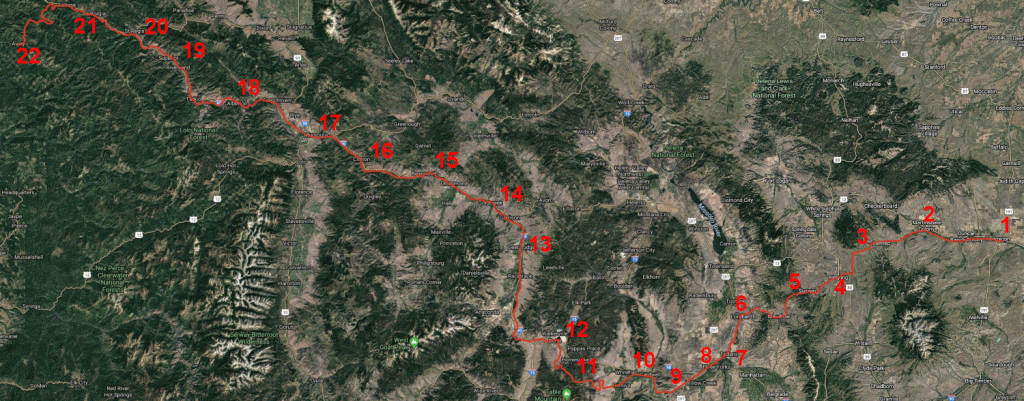
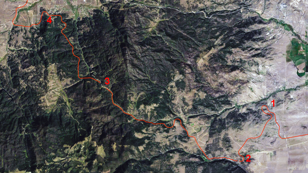
The Milwaukee’s full route between Harlowton (at right) and Avery (at left.) Its 280 miles as the crow flies, yet an extra 150 by rail!
1 Harlowton 2 Martinsdale 3 Loweth 4 Ringling 5 Sixteen Mile Creek 6 Lombard 7 Trident 8 Three Forks 9 Sappington 10 Jefferson River 11 Pipestone Pass 12 Butte 13 Deer Lodge 14 Gold Creek 15 Drummond 16 Clinton 17 Missoula 18 Alberton 19 Superior 20 St Regis 21 Haugan 22 Avery
I gave it a go and shown above is the map I compiled (based on Google of course) showing the complete 440 miles of formerly electrified Milwaukee Road as it works its way through Southern Montana and into eastern Idaho. Even this large map doesn’t do the line justice because there are far more twists and turns in the route than can be shown here!

In all of its official maps the railway is shown as a straight line across the Rockies! The 440 mile electrification section between Harlowton and Avery is clearly shown. Source: Wikipedia.
Harlowton to Butte
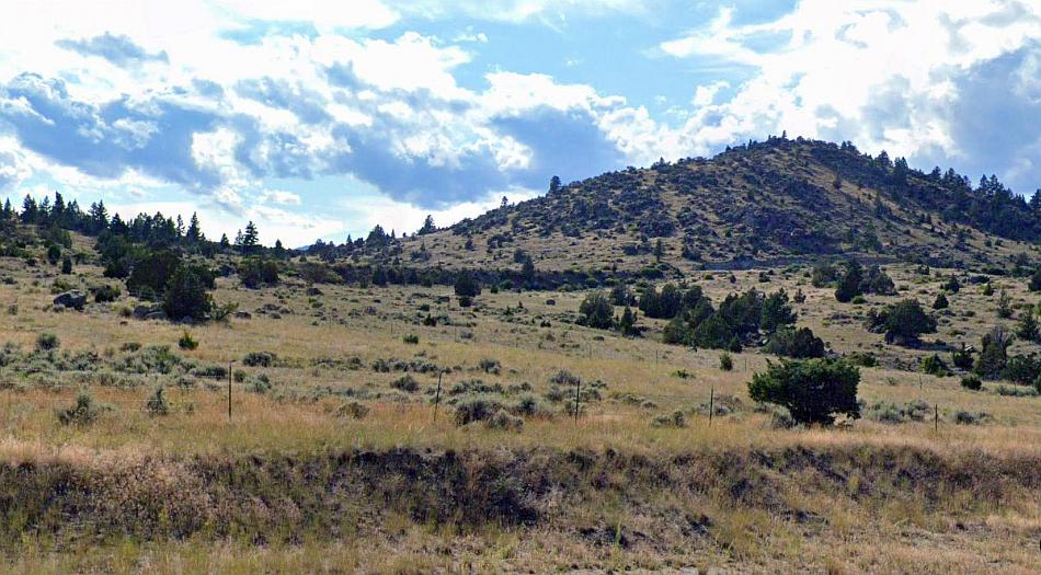
Harlowton is the easternmost extent of the former Rockies Division of the Chicago Milwaukee St Paul and Pacific Railroad. The images I found on Google Streets for this location were of very poor quality (as are a number of other locations en route) this really there isn’t anything of merit on Google Streets (its all quite isolated and away from the main roads anyway) until the line reaches the first of the electrified line’s three summits – this goes over the Belt Mountains at Loweth.
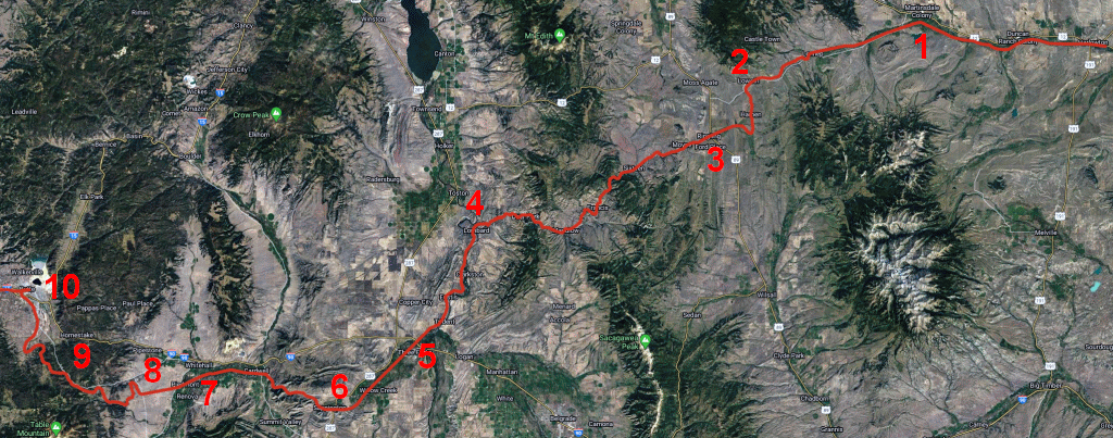
Harlowton to Butte: 1 Martinsdale 2 Summit 3 Ringling 4 Lombard 5 Three Forks 6 Sappington 7 Piedmont 8 Vendome loop 9 Pipestone Pass 10 Butte
The 3,000 volt (later 3,300 volts) DC line needed a substation roughly every 30 to 37 miles and there were twenty two of these built. There’s just four left the rest having been demolished. The first was at Harlowton and that’s no more. The next, substation number two, is at Loweth.
The line’s first substantial loop near Loweth – characterised by the electricity poles along its route. Google Streets.
In terms of Loweth being a summit, the company attempted to make the steep ascent either side somewhat easier. What this means is the original line passed outside the substation itself however in the fifties a new deviation was built within a deep cutting passing behind the substation.
It seems there was once a crossing to the east of Loweth/Summit. Google Streets.
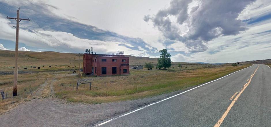
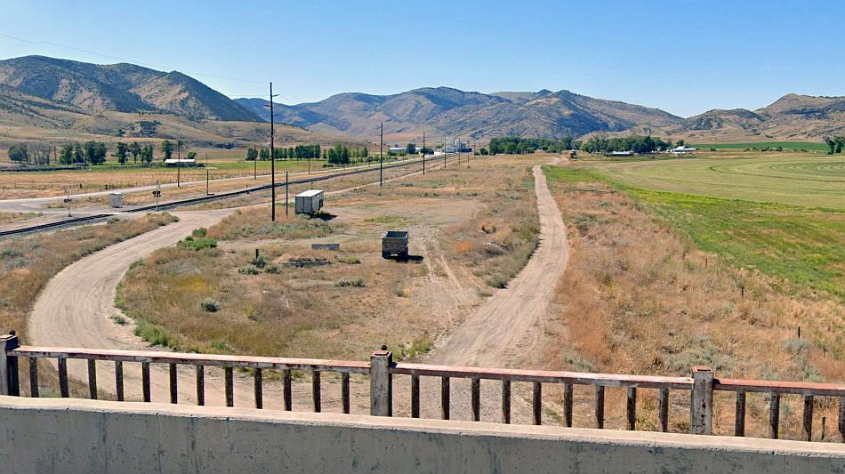
Loweth/Summit. This is one of four sub stations remaining on the Milwaukee’s Rockies route. Google Streets.
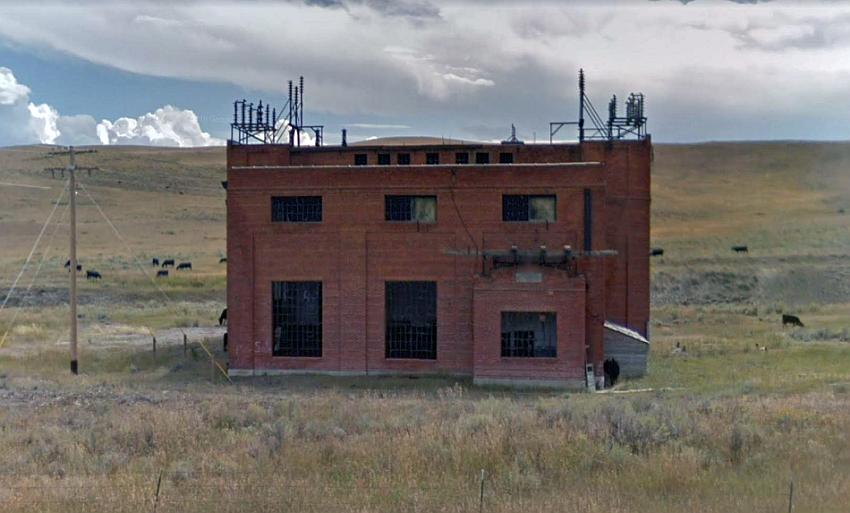
Close up of the old substation, built c1915. The line’s old route was in front of this. The newer 1950s line (in a cutting) can be seen behind. Google Streets.
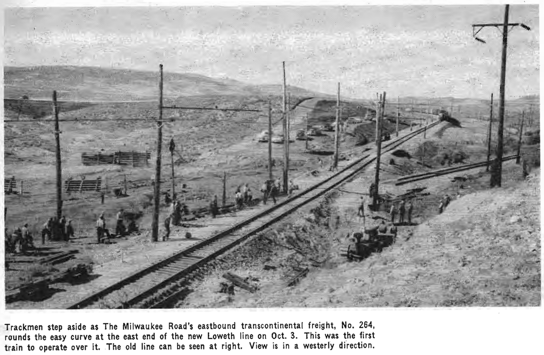
The old and new order at Loweth. The first train over the new deviation is seen here. October 3rd 1956. Source: SM Works
Ringling junction. This is just east of the station. The Milwaukee once had a branch off to the left to White Sulphur Springs. The main line back to Harlowton goes straight across the country. Google Streets.
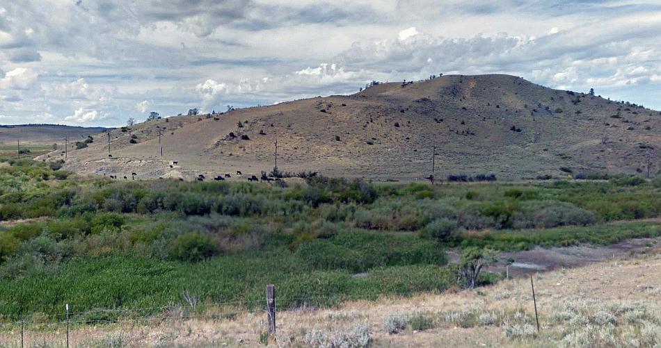
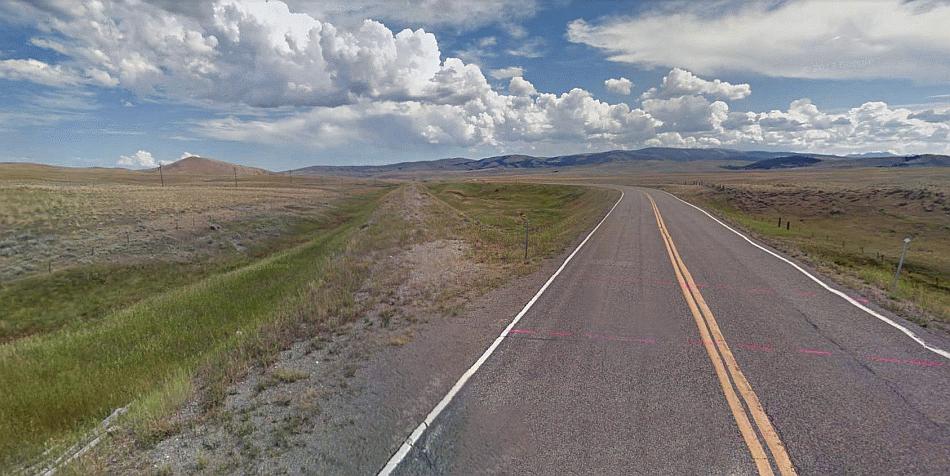
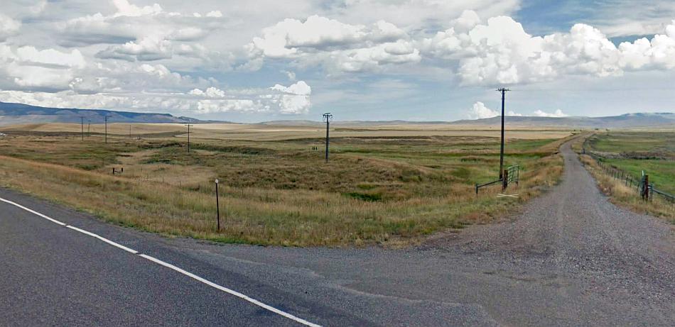
From Loweth the line goes over over the mountains to Ringling (very poor pictures here from Google) before following the Sixteen Mile Creek (a long, isolated stretch between 3 and 4 on the map which the Milwaukee company in part called it Montana Canyon) and the Missouri etc as far as Three Forks. There’s practically nowhere along this section that has any main roads (except for a glimpse at Trident) thus its not covered by Google, which means its Three Forks to the bottom of the Pipestone Pass that has a reasonable amount of coverage on Google Streets. There’s little to see in Three Forks however because the Milwaukee is now mostly roads.
Sappington. The Milwaukee route was where the grassy patch (lighter shade) on the right side of the dirt track in the middle is. There was once a station here. The mills in the distance, along with another in Three Forks, produce most of the world’s talcum powder! Google Streets.
In the above image the Milwaukee can be seen heading straight for the Jefferson River – this is the cleft in the hills seen above the route of the Milwaukee. The images from Google were very poor along the Jefferson River route so I left those out sadly! We go straight to the far side of Piedmont where the line began its ascent up to the top of the Pipestone Pass.
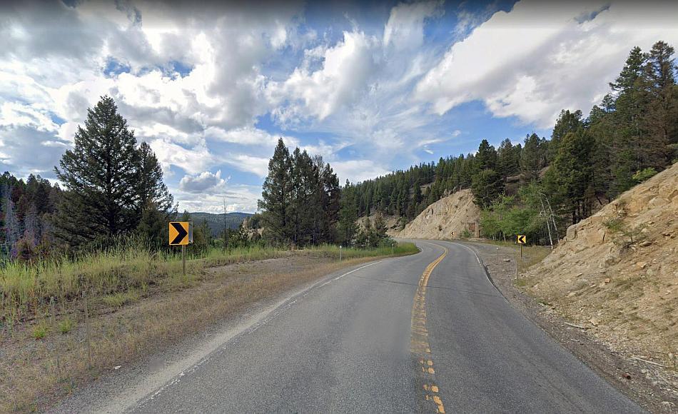
The course of the former Milwaukee Road as it curves across the countryside towards the Vendome loop and the Pipestone Pass. Much of the route is still characterised by electric distribution wires which remained long after the line closed, and are still used. Google Streets.
These power wires seen in this picture actually avoid the Vendome loop and go straight up the hills to rejoin the former railroad on the far side where it turns to ascend the Pipestone Pass.
In this image one can see part of the railroad embankment (roughly straight across the centre of the picture) that forms the ascent up the Vendome Loop (and ultimately the Pipestone Pass.) Google Streets.
Here’s a map just to help things along! The above view would roughly be a short distance south of where the 1 can be seen. The line would have gone round back of the hill in order to attain the next higher level upwards.
Pipestone Pass: 1 Vendome loop 2 Fish Creek Tunnel 3 Top of pass & Pipestone tunnel (6347ft) 4 Janney

The Olympian Hiawatha at Fish Creek Tunnel – numbered 2 on the map. The train just has ascended the Vendome loop and is high above the Fish Creek canyon. May 1953. Source: Twitter
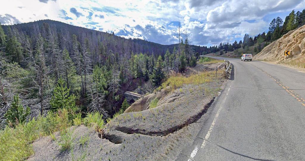
The Pipestone Pass is not well covered. Even when the Milwaukee line was in operation enthusiasts found it difficult to get the necessary access to take photographs of trains. These days most of the route is out of bounds which means just a few highlights of this spectacular section which attained a height of 6347 feet above sea level, can be seen. However in 1915 a lot of photographs were taken showing the prowess of the new electric locomotives on these steep gradients.
However one single shot on Google Streets can be found where the eastern portal of the Pipestone tunnel is just glimpsed form the road over the top of the pass…
The now closed Pipestone Pass tunnel can just be seen in this Google Streets view!
There are a handful of photos showing trains at the entrance to the Pipestone Pass tunnel. Some pictures show a sign commemorating the fact its where the Continental Divide is crossed. Pictures of the inside of the tunnel shows there has been a partial collapse.
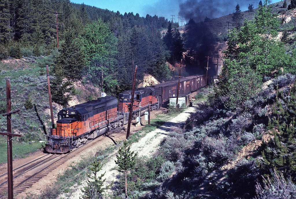
Six years after electrification had finished a pair of diesels with an eastbound freight burst out of the south eastern portal of the Pipestone tunnel – look at the diesel fumes! The road over the summit can just be seen at top right. Source: Flickr
This short video on Facebook shows a Little Joe in charge of an eastbound freight as it leaves the tunnel entrance.
Top of the Pipestone Pass – number 3 on the map – looking north west. This is just over the Continental Divide. The railroad’s tunnel emerges from just below the road to the left and heads towards Blacktail Creek. Google Streets.
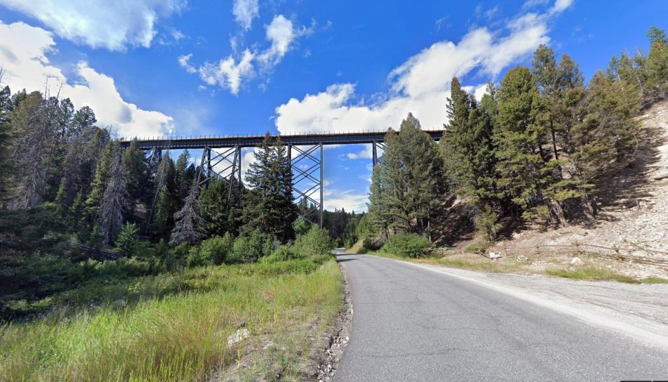
Blacktail Creek Trestle just northwest of the Pipestone tunnel. The crossing is one of the highest on the eastern half of the Rockies division. Source: Google Streets
This is the view looking from Janney station up the former railroad’s gradient towards the Pipestone Pass. Its not a very good image however the upwards incline is clearly seen. Google Streets.
Butte has a lot of railways! The one line missing these days is of course the Milwaukee’s. The Chicago Milwaukee and St. Paul wasn’t the first electric railway in Butte, the other company, the Butte, Anaconda & Pacific had been running these since 1913 at 2400 volts DC. Both lines shared the same route for a distance.
South Montana Street in Butte. (marked on the map where Freeway Tavern is shown.) This part of the Milwaukee Road is still rail served to a depot on the south side of the city. The line curves to the west as if to avoid the city altogether – but that’s for a reason, so it can both serve the city and the route westwards. Google Streets.
The grand terminus at Butte was closed in 1957 and replaced by a simple station in Josette Avenue on the south side of the City. This new station, last used in 1961, is still extant as a training center and can be seen on Google Streets.
The reason Butte was well gifted with railroads – especially the early electrified type – was because it was a prosperous mining town, known at one time as ‘The Richest Hill on Earth.’ It is said people thinking of emigrating to the states were told ‘Don’t stop in America, go straight to Butte!’ Maybe its riches were perhaps a reason why the Milwaukee Road headed here! The trouble was every other US railroad was coming here too – thus the Milwaukee had to share its new route with its competitors. In fact for much of the route from Butte to Saltese the Milwaukee constantly accompanied one, sometimes two, other railroads.
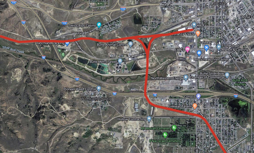
Map of Butte. Butte station is the stub of line to the right. The arrangement of the tracks outside the station is clearly evident, it may not be absolutely accurate though! There was a crossing of the Silver Bow Creek but the embankment and bridge are no longer there.
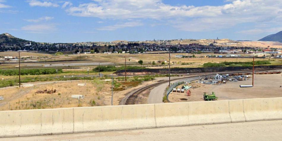
Looking from the highway to the south of the Silver Bow Creek. The Milwaukee line headed straight across the creek on a trestle then split into two – one towards Butte station (whose building and clock tower can be seen at far right.) The railway that can be seen is the Union Pacific’s track. Google Streets.

1979 view showing the trestle over the Silver Bow Creek. The other line which is still present can be seen in the foreground. By this time the Milwaukee had got rid of its once highly esteemed electric operations and it would be just one more year before the line closed for good. Source: Flickr.
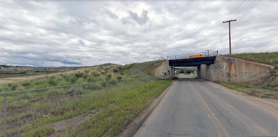
Centennial Avenue bridge in Butte. The Milwaukee crossed the road here.I think its about where the Milwaukee’s lines split with one line going towards Butte station and a pair towards Deer Lodge. Google Streets.
The next picture is of a passenger train – possibly the Olympic Hiawatha express – and its obviously not stopping at Butte! Its heading along the direct curve towards Centennial Avenue.

On the Butte avoiding curve. Source: Dons Depot.
Butte is interesting in that it had a substantial passenger terminus. As mentioned it was on a spur off the main route. Reversal had to take place of if a train was continuing its journey. The junctions just outside Butte however enabled express or freight trains to avoid the station.
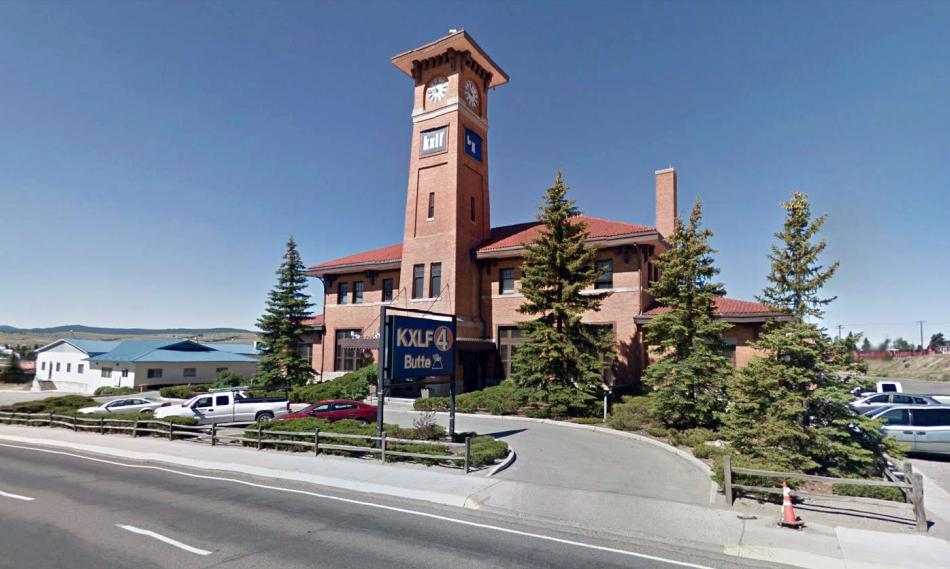
The historic Butte station. Now a radio and TV studios! This view is from 2012. Google Streets.
Butte station was sold off in the sixties when the Milwaukee ended its passenger services. Today its the home of KXLF Radio and Montana Television Network.
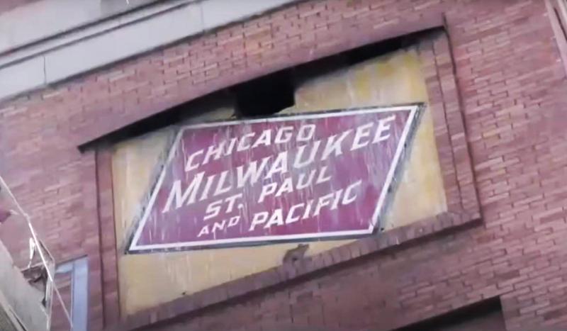
The former Milwaukee sign on the clock tower before it was removed. Source: You Tube
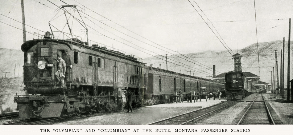
Butte station in 1920 with two of the Milwaukee’s express trains present.
The only other station on the 440 mile route which had a building of any large size was at Missoula.
Part Two: Butte to Missoula
The full list of posts featuring the Milwaukee’s Rockies Mountains electric division:
Introduction:
Electric Railroad through the Rockies
Electric Railroad through the Rockies #2
Milwaukee Road then and now – Harlowton to Avery:
Part One: Harlowton to Butte
Part Two: Butte to Missoula
Part Three: Missoula to Saltese
Part Four: Dominion to Avery
Milwaukee Picture Galleries: