The second part of this special gallery of Milwaukee Road scenes! Most are from Flickr pools – and not even featured on Google’s pages. Many fascinating pictures – and great photographers who captured these scenes!

Drummond between Deer Lodge and Missoula. One of the few stops on the Rockies division to retain semaphore signals. Source: Flickr

The sidings at Drummond were west of the depot. The bridge is the Pintler Veterans Memorial scenic highway. Source: Flickr
Here’s a view of the Drummond site from the Pintler Veterans Memorial scenic highway – as seen on Google Streets. Difficult to believe this is the same location!
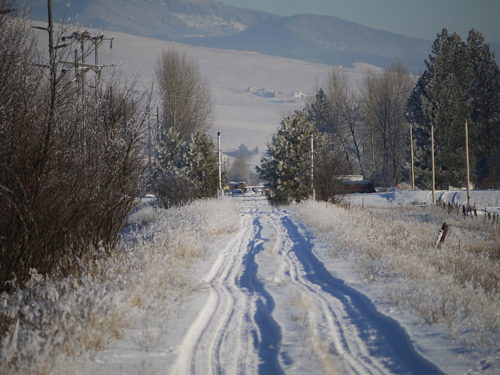
Snow bound former MILW tracks at Huson in 2013. A pair of signal posts still stand 33 years after the last train. Source: Flickr

Houses have been built here at Soudan by way of removing the railroad embankment. In the distance can be seen the piers of the former bridge over Frontage Road. Source: Flickr
A good picture of the bridge with a Little Joe and a pair of Alcos on a freight crossing the Frontage Road can be seen on this tweet.
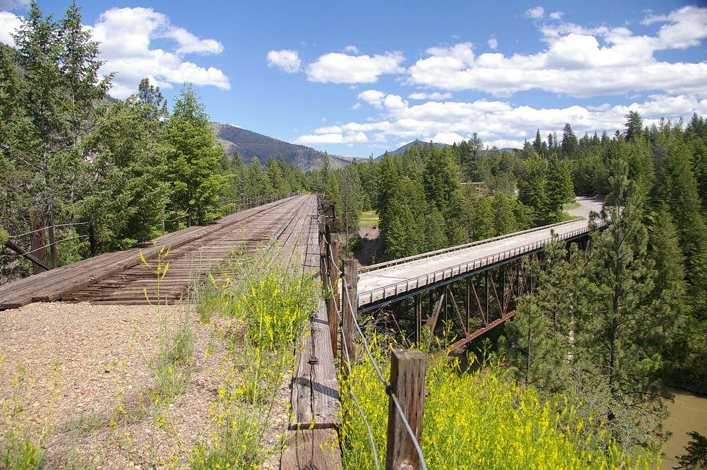
The disused Milwaukee bridge near Alberton. The source page says Cyr but its not clear which it is, as the one further east is also known as Cyr. There was once two rail bridges here. Just the Milwaukee’s remains. Source: Flickr
A view of this bridge sited in Alberton Gorge can be seen from the old highway on Google Streets.

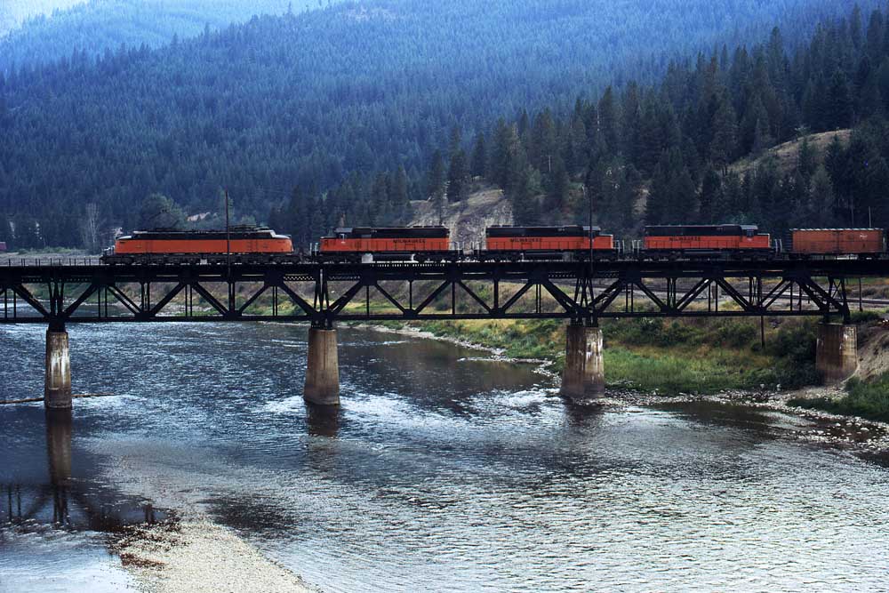
Great shot of two Little Joes and a Boxcab south east of St. Regis. Source: Flickr
Little Joe acting as helper on an eastbound freight crosses the Clark Fork River at St. Regis. Source: Classic Trains.
Love this! Rare to see semaphores in use however this at Haugan survived until possibly the late fifties. Source: ww2aircraft.
The section from St Regis to Haugan was often used by Northern Pacific too where a connecting spur at Haugan linked to the Northern Pacific tracks. The NP had their own route over the Bitter Root mountains via the Lookout and Mullan Passes. Sadly like the Milwaukee too this route is no longer extant save for a section from Mullan to Wallace.
Northern Pacific 4020 joins the Milwaukee Road with a freight from Wallace to St. Regis. August 1950. The connection from the NP was to the rear of the train. Source: Montana Memory Project.

The Milwaukee Road at Haugan after the line had closed. Note the replacement colour light signals. 1980. Source: Flickr.

Little Joe at East Portal which is on the Montana side of the St. Paul tunnel. Source: Pinterest.

This is Tunnel 27 (Loop no 2 tunnel) at Adair with its PS or ‘Puget Sound’ engraved on the portal. Source: Flickr
A succession of tunnels on the St. Paul’s Pass section had the initials CM&PS engraved on their portals (inc tunnels 22, 25, 27, 28, 29 and 30) which denoted Chicago, Milwaukee and Puget Sound railway. In fact in the early days of the new line boxcars and cabooses had that name painted on their sides. Not long after however the company reverted to using St. Paul in their title thus it became the Chicago Milwaukee St. Paul and Pacific Railway – changed to railroad in 1927. The ‘Saint Paul’ evidently referred to either the other twin city (as had been the case in the past) or the new St. Paul pass route the line took over the Bitterroot mountains.
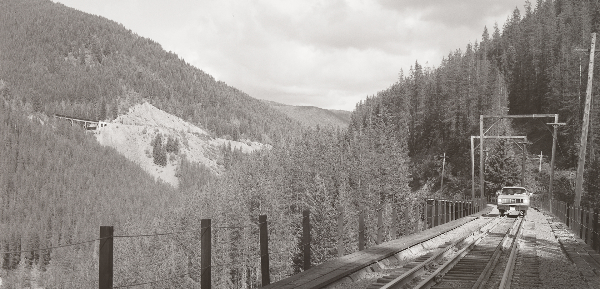
Apart from the modern pictures of the trail that exists between East Portal and Pearson, its very difficult to find any historic ones of the stupendous line that threaded through the mountains of Idaho. This view is great because it shows the significant elevations the line had to climb but its also one taken just after the Milwaukee Road had closed this its of historical significance too. Its evidently from the famous Milwaukee Road Abandoned Trip of 1980/81. Source: Rail Photo Art.
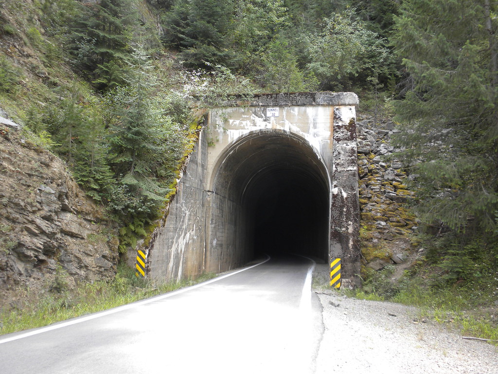
Tunnel no.32 – also known as Glade Creek tunnel No.1. This is between Pearson and Avery. At least three of the tunnels on that section were given over to highway traffic. This was built over the old Milwaukee Road upwards from Avery in order that people could access the scenic countryside around Pearson and Falcon. Source: Flickr

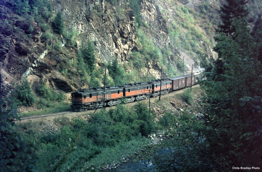
Great shot of a Little Joe crossing one of the trestles north of Avery 1972. Source: Flickr
Lovely shot of a Boxcab on the approach to Avery in 1972. Source: Flickr

A venerable boxcab viewed from the highway at Avery in 1972. These were introduced for the line’s opening in 1914 and were getting on for sixty years of age when the plug was finally pulled on the Milwaukee’s famous electric services. Source: Flickr

Nice shot of a Little Joe at Avery waiting to act as helper for an eastbound freight over the steep mountain grades. Source: Pinterest
Avery again! As dusk approaches rail staff probably doing some work on the sidings. A Boxcab stands by and a pair of Little Joes prepare to haul their freight over the mountains. Source: ww2aircraft.
Next: MILW picture gallery #3 Seattle & Tacoma
The full list of posts featuring the Milwaukee’s Rockies Mountains electric division:
Introduction:
Electric Railroad through the Rockies
Electric Railroad through the Rockies #2
Milwaukee Road then and now – Harlowton to Avery:
Part One: Harlowton to Butte
Part Two: Butte to Missoula
Part Three: Missoula to Saltese
Part Four: Dominion to Avery
Milwaukee Picture Galleries: