This is the second part of a look at whats left of the railroad’s 440 mile route through the Rockies and covers the section from Butte to Missoula. The line follows the Clark Fork River for most of the way (as it does in fact all the way to St Regis.) It looks a fairly straightforward route, however because the lines that had then been built had the better route (mainly on the north side of the river) thus the Milwaukee had to use the south side for most of the route. As a result the Milwaukee had to use a more sinuous course which too involved additional earthworks and tunnels.
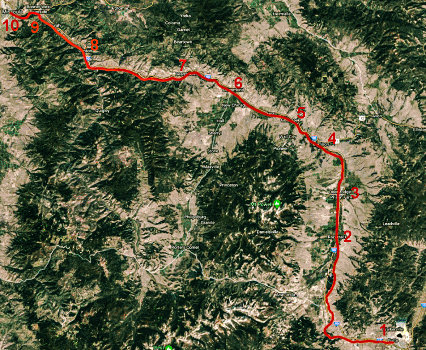
Map of the section from Butte to Missoula.
1 Butte 2 Racetrack 3 Deer Lodge 4 Garrison 5 Gold Creek 6 Drummond 7 Bearmouth 8 Clinton 9 Tunnel 16 10 Missoula
The first part of the route out of Butte is alongside the curiously named Santa Claus Road. I don’t know why its called that – and the internet doesn’t reveal anything!
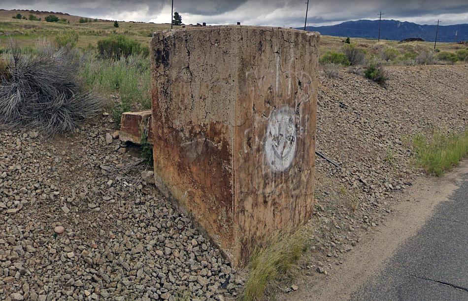
Concrete CMSP&P signal base by the side of Santa Claus Road near Butte! Google Streets.
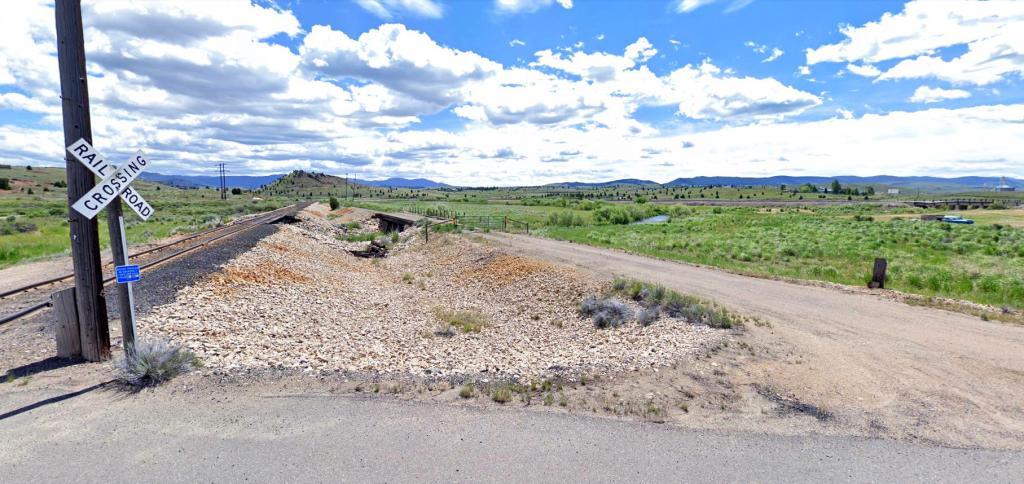
Three small bridges and three railroad crossings on Silver Bow Road to the west of Butte. The furthest one (still in use as a railroad) is in the distance. And the middle one? Its the abandoned Milwaukee Railroad. That at left is the former Butte, Anaconda and Pacific railroad. Google Streets.

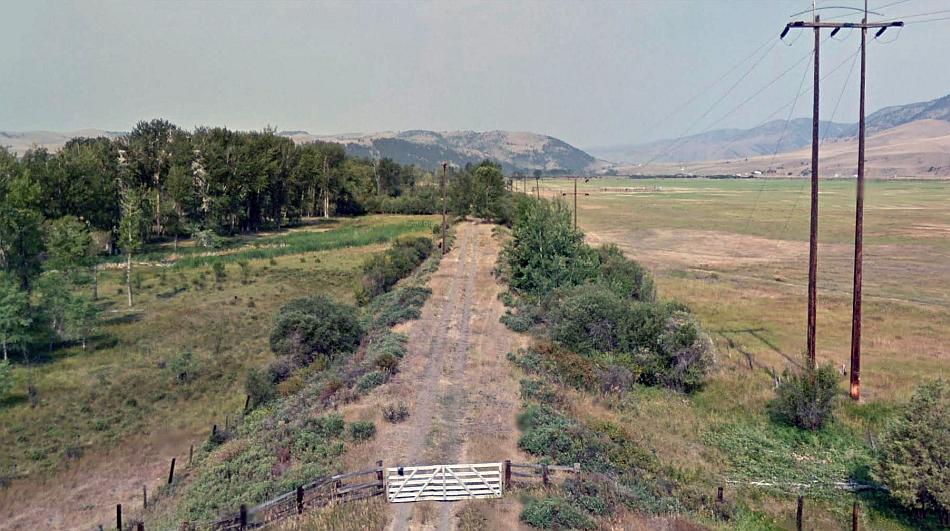
Two crossings for the price of one (and a truck thrown in for free!) A substantial Milwaukee embankment links these two crossings – a trestle and a concrete bridge at Crackerville Road, south of Deer Lodge. Google Streets.
The Milwaukee line runs straight through Racetrack (like the other railroads and the main highway do too) and it runs as straight as an arrow for miles to a point north of Deer Lodge. But Racetrack isn’t anything to do with road (or train racing perhaps!) Its actually where the the first ever horse races took place. Indians used to race their horses along here because the track was so straight. The miners who settled here took up a love of horse racing too!
The first road into Deer Lodge runs alongside the old rail alignment (at left.) At right (and just visible) can be seen the Little Joe locomotive that is a permanent fixture in the town itself. Google Streets.
Deer Lodge is the second oldest town in Montana. Its had several names previously such as LaBarge City, Spanish Fork, Cottonwood, and was once a gold rush settlement after the first ever gold in Montana was discovered in Gold Creek during 1852.
The town has a couple of museums and also a railroad exhibition featuring three lots of rail stock from the Milwaukee as well as a commemorative memorial to the ‘last spike.’ The actual spike was made of gold to commemorate the fact the route from Chicago to Puget Sound on the Pacific Coast had finally been completed.
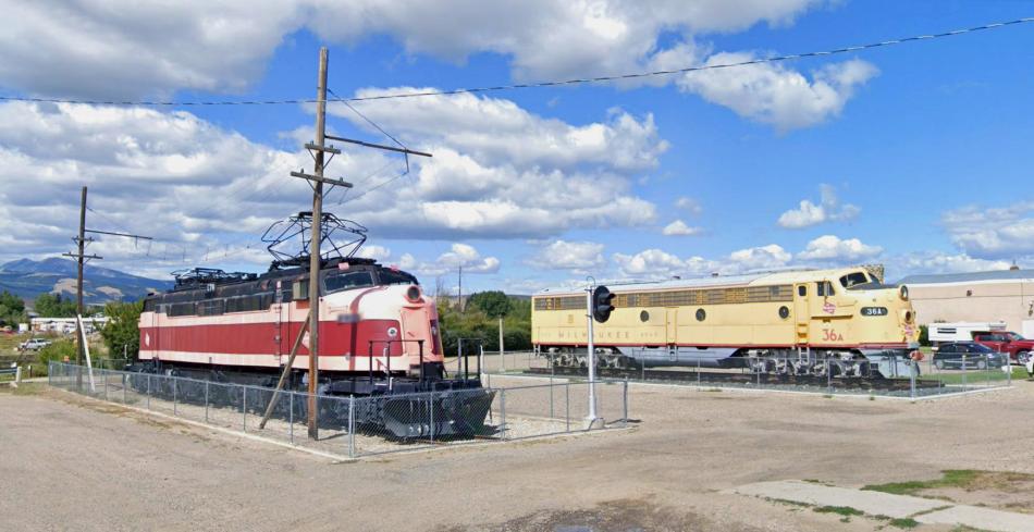
Milwaukee electric and diesel locomotives at Deer Lodge. Google Streets.
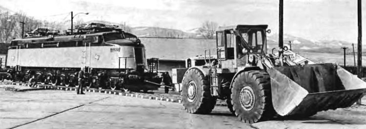
Locomotive E70 being hauled through the streets of Deer Lodge on temporary track to its new location. December 1973.
The work to complete the line had been considerably delayed in 1908 when over 70 miles of the Milwaukee’s partially finished new formation (as well as the parallel Northern Pacific’s route) were washed away in a massive flood.
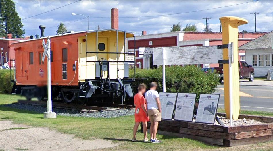
A Milwaukee caboose can also be seen at Deer Lodge. The display the couple are reading details the story of the Milwaukee’s construction and the last spike ceremony on 19 May 1909. Google Streets.
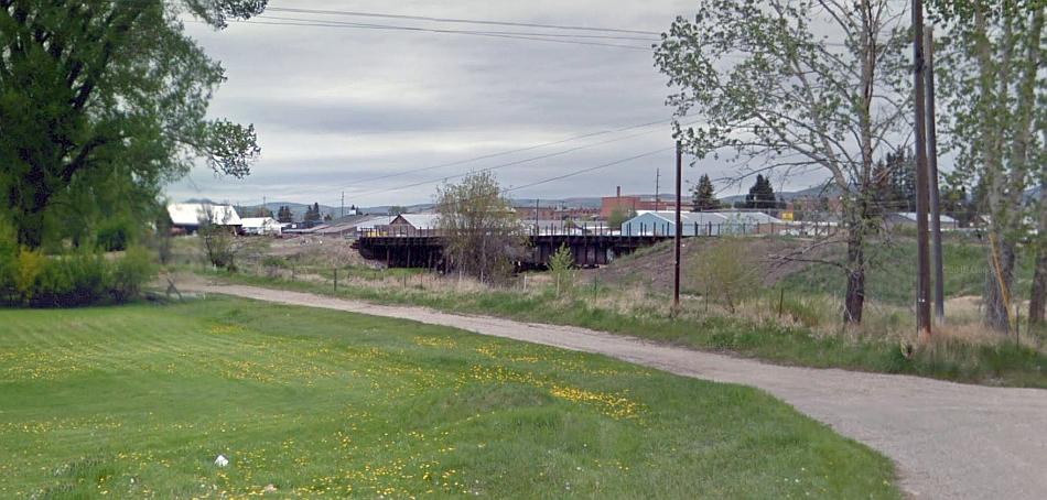
Just north of the Deer Lodge railroad exhibition, a disused Milwaukee trestle bridge can be seen crossing the Cottonwood Creek. This view is as near to it as Google Streets would allow.
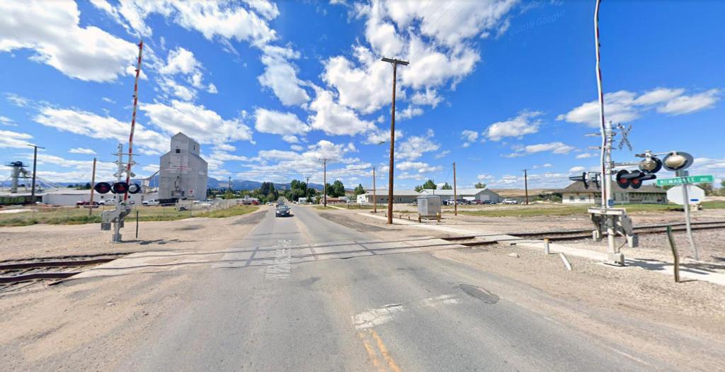
Milwaukee Street crossing – which marked the southern end of the station precincts. The Milwaukee’s route once ran along the far side of the crossing. Deer Lodge’s station building can just be seen at right. Google Streets.
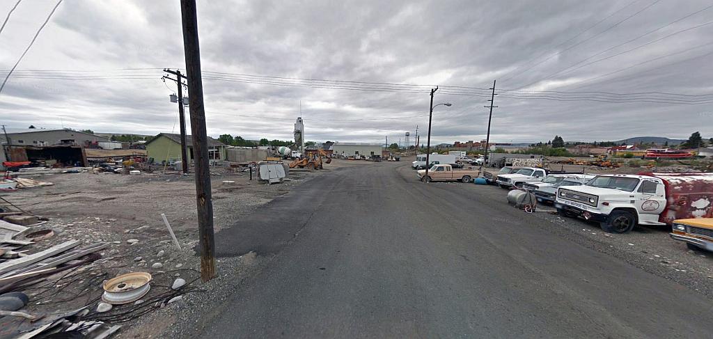
Deer Lodge was where the Milwaukee’s main depot and repair for the 440 mile electrified route was. The reason for the location being chosen was it is roughly halfway along route – around 200 miles of it in either direction. The locomotive depot was to the west side of the line, and although there’s no direct view of the site, this Google Streets scene does show the largely vacant land to the rear that was once the locomotive yards.
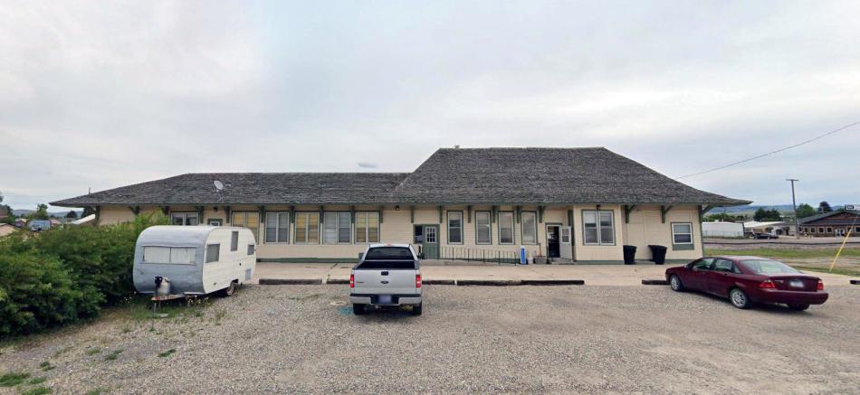
This is Deer Lodge station. Its still in use though not for railroad purposes. The former Milwaukee tracks which ran in front of it (on the other side from this view) are no longer there of course. Google Streets.
This view looking north from the crossing shows how set back from the present railroad the station building is. That vacant land was once the Milwaukee’s!
The next picture is a historic one of the line in its last days of electric operation (yes those are diesels not electrics!)
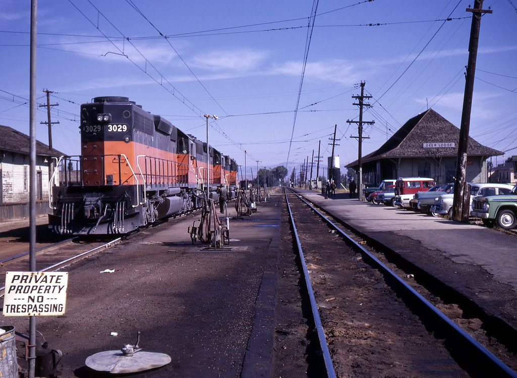
Diesels at Deer Lodge in 1972. Source: Flickr
Earlier it was mentioned the Milwaukee’s route had been completed in May 1909. Despite the line commencing operations almost immediately, the company’s famous express trains did not begin for another two years. This next picture is not of great quality (I also colourised it too) & shows the first ever arrival of the new Olympian Express at Deer Lodge.
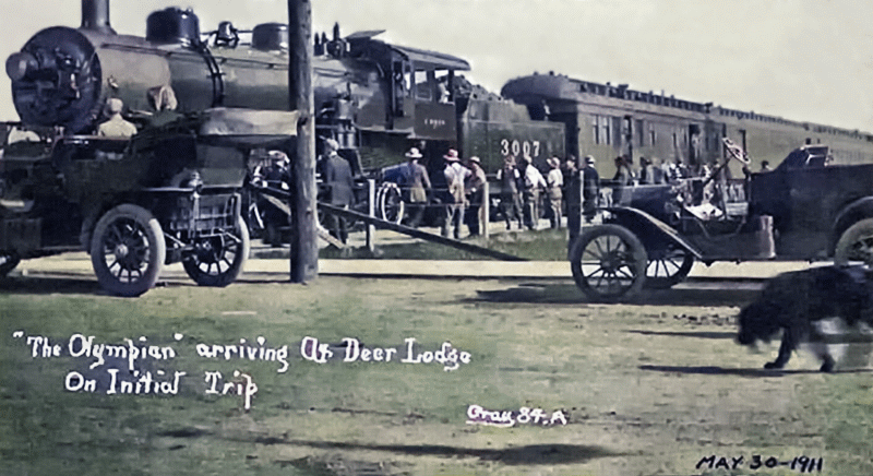
The Olympian arrives at Deer Lodge for the first time. May 30th 1911.
The final passenger trains to run all the way on the Milwaukee’s Pacific extension ended service in 1961. However from 1961 to 1964 a rudimentary, un-named, passenger service was retained between Minneapolis and Deer Lodge. Railroad employees sarcastically called it ‘The Limpin Hiawatha!’
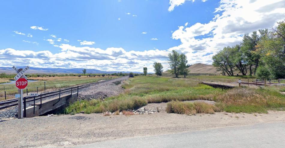
Minor bridges at Rock Creek Cattle Road about midway between Deer Lodge and Garrison. That on the left is the former Northern Pacific’s (now managed by the Burlington Northern.) The Milwaukee’s bridge can be seen on the right. Google Streets.
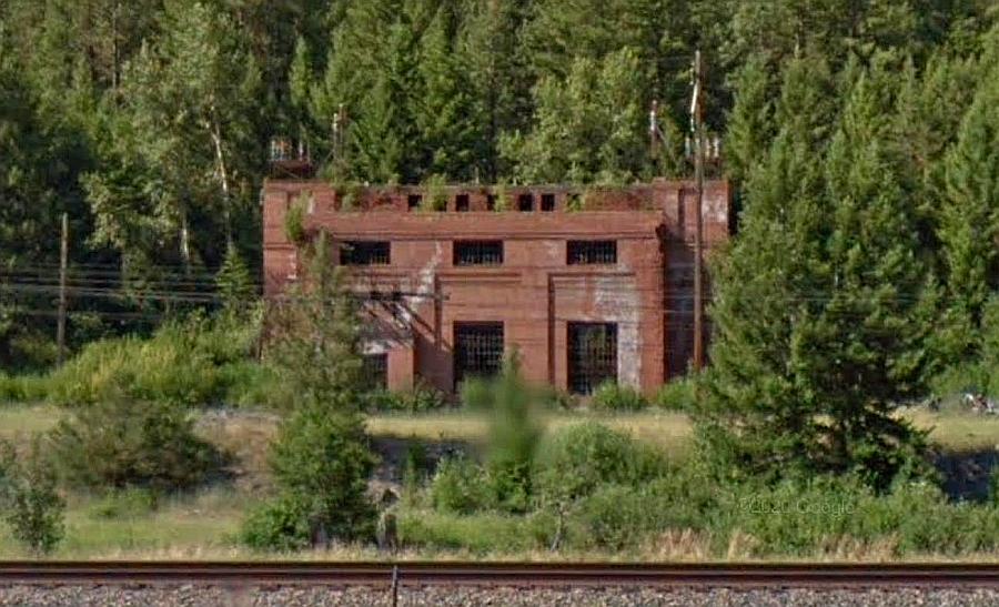
Throughout most of the route between Deer Lodge and Missoula the Milwaukee is on the far side of the river as earlier explained. It means there is little in the way of Google Street views of the line. Some tunnels and bridges can be seen form the main roads on the north side of the river. I had thought about including these but decided no as these were quite far off and wouldn’t make good pictures. Despite this there are some nice surprises as we shall see. The first of these is the substation at Gold Creek. There are just four of these left and at least three can be seen on Google Streets!
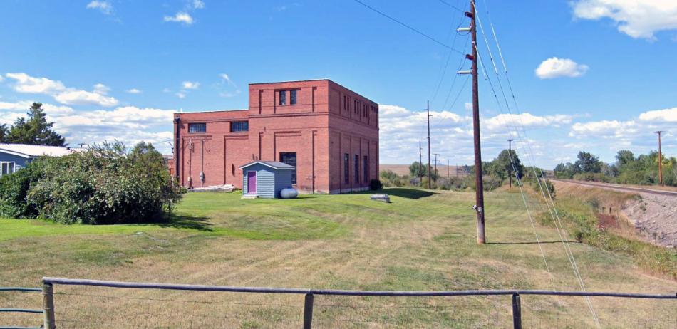
The substation at Gold Creek. The Milwaukee ran in front of the building as evidenced by the electricity poles. Google Streets.
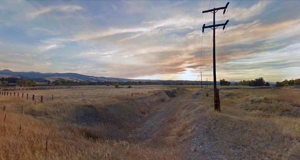
A rarity on Google Streets! A lovely sunset at Jens Road. The Milwaukee had a minor cutting which can be seen here looking in the direction of Drummond. This part of the former railroad is at least on the north side of the Clark Fork River.
The railroad’s formation as seen from the Veterans Memorial Scenic Highway bridge near Drummond. The Clark Fork River route is quite wide at this point but it soon narrows as seen in the distance and this is where each line through the area kept to their particular sides. Google Streets.
UPDATE June 2020:
I missed this picture of the Ravenna substation! It can be seen from the US Highway and is located on the far side of the Clark Fork River between Bearmouth and Clinton. It means the four remaining substations on the Rockies section can all be seen on Google Streets. These are Loweth, Gold Creek, Ravenna and Primrose.
Ravenna substation as seen from US Highway 12. Source: Google Streets
As mentioned earlier there are bridges and tunnels that can be seen from the main road alongside the Clark Fork River. No pictures of these are available as far as I can see and those on Google Streets are just too far away to see these properly. The next picture however has a nice surprise for this is the entrance to Tunnel 16 to the south east of Missoula. This tunnel was necessary because a rocky prominence right against the Clark Fork River formed an obstacle which the railroad had to tunnel through. The Northern Pacific on the other side of the river had no such obstacles!
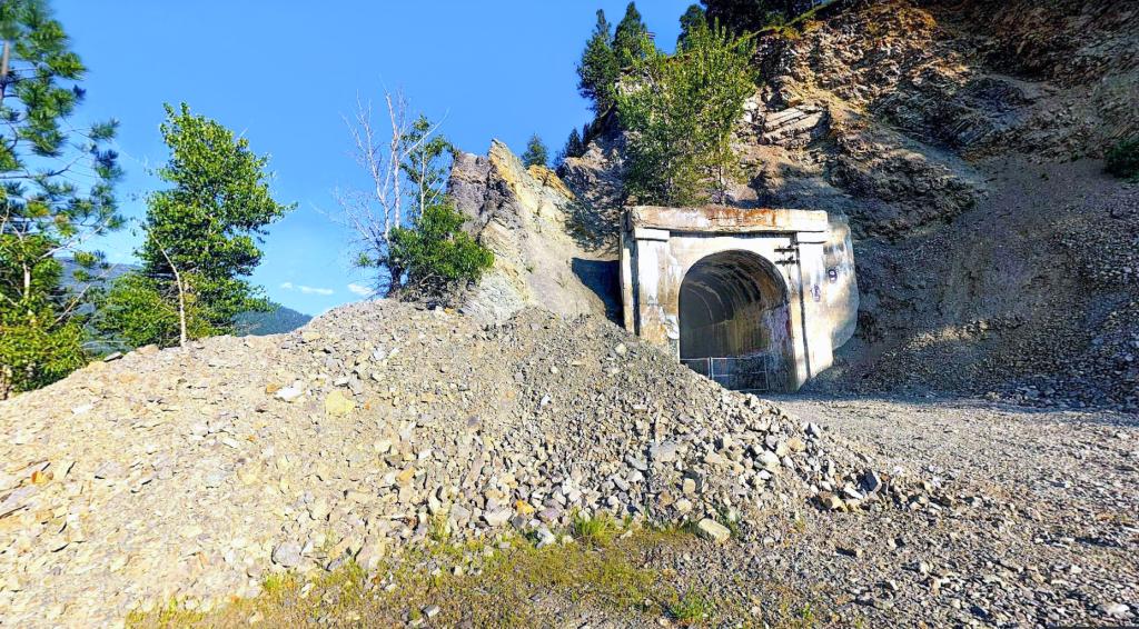
The northern portal of Tunnel 16 near Missoula. Google Streets.

For the sake of historic prosperity here’s a nice picture of a freight which has just emerged from Tunnel 16. It has a jovial locomotive engineer too! The tunnel portal is just out of sight to the rear of the train. Source: Pinterest
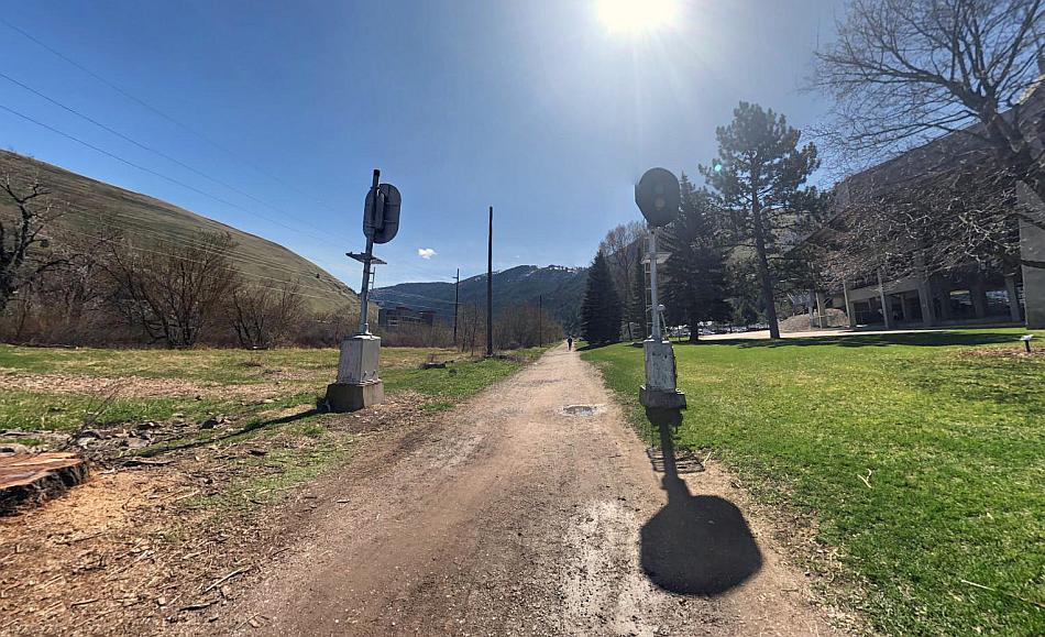
These former Milwaukee Road signals are just outside the Washington Grizzly Stadium in Missoula. Google Streets.
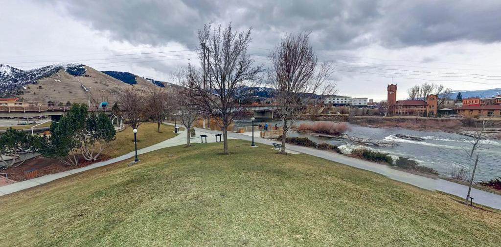
The line’s alignment on the final section to Missoula station now forms part of the John H. Toole Riverfront Park.
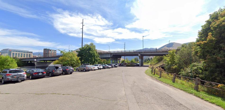
The alignment of the Milwaukee Road can be seen where it once passed under the river bridge at Missoula. Google Streets.
As has been mentioned previously, the only two large station buildings on the Milwaukee’s Rockies division route were at Butte and Missoula. Both are of course notable for their towers – these being something of a penchant the company built at its major stations.
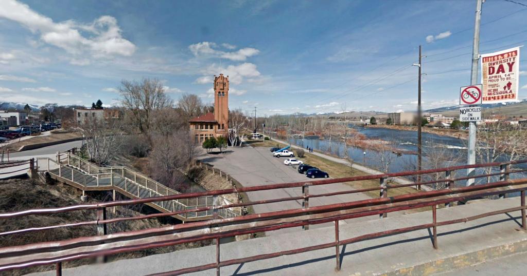
Missoula station seen from the South Higgins Avenue bridge. Google Streets.
Looking at the picture above it seems the topmost part of the station’s tower has the face of a guy with a rather large nose and big ears! Definitely not my imagination!
Missoula is the second largest city in Montana and its at the confluence of several rivers as well as the juncture of five different mountain ranges! Logging was the city’s main occupation until the 1980s when a recession set in. It seems from accounts of the line there was just one main carrier using the railroad at that time – and the company saw it as totally uneconomic to keep a near 2000 mile long rail route just for this one carrier.
Missoula station commands a prime riverside location in the city. Google Streets.
Missoula Station is unusual that it commands a prime site by the river, however the parcel of land between the building and the river is quite narrow, which meant the Milwaukee’s freight depot had to be further west where the alignment was well away from the river.

Missoula station with a pair of Little Joes at its one platform. Probably early 1970s. Source: Pinterest

Bridge over the Milwaukee Road at Orange Street, Missoula. Note the position of the power mast in this and the next picture. Source: Picryl
The same view today. The old concrete bridge has been replaced by an embankment consisting of a wider highway. The power mast isn’t the original but its in the same location. The church seen in the distance (with the building on the left of it) are in both views. Google Streets.
As mentioned the railroad yards at Missoula were a little further west from the station on the far side of Orange Street bridge. Here’s a picture of a pair of Little Joes in the yard with a comparable modern view…
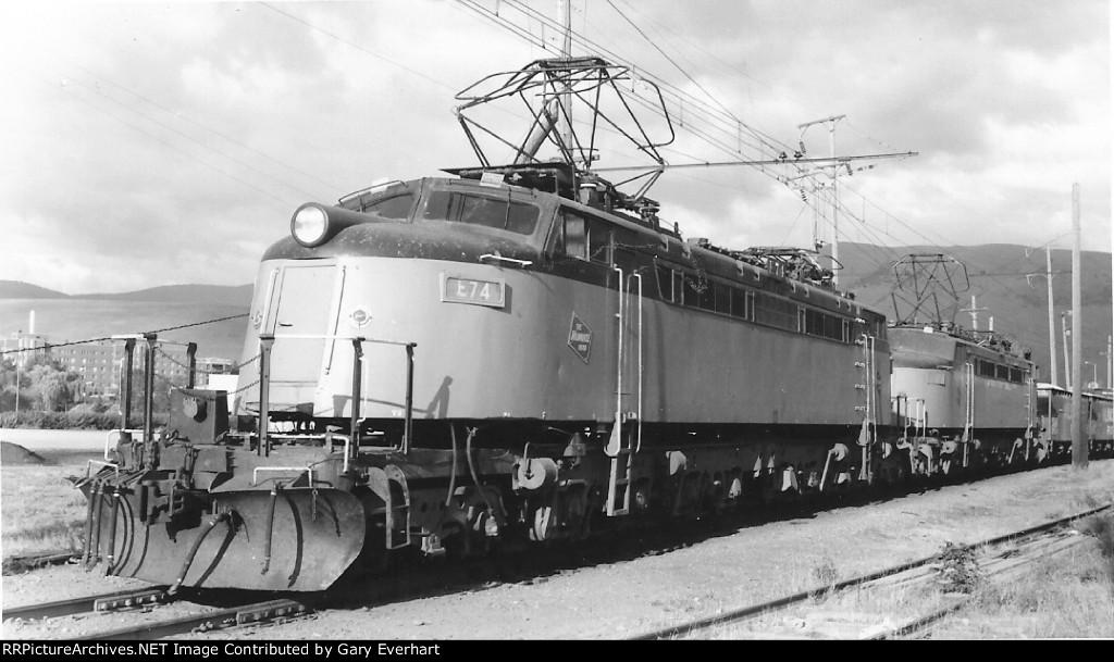
Little Joes at Missoula in 1972. Source: rrpicturearchives
The building seen in the distance at left in both views is the city’s St. Patrick Hospital. The original building can be seen in the 1972 view and its modern replacement in the 2012 view.
Almost the same view in 2015. The site is now partially occupied by the Montana Natural History Center (off pic on right.) Google Streets.
The Milwaukee route passed underneath its competitors’ line, the Northern Pacific at the rear of this building – and whose bridge and rails still exist as part of the Montana Rail Link. This is near Hickory Street, Missoula. Google Streets.
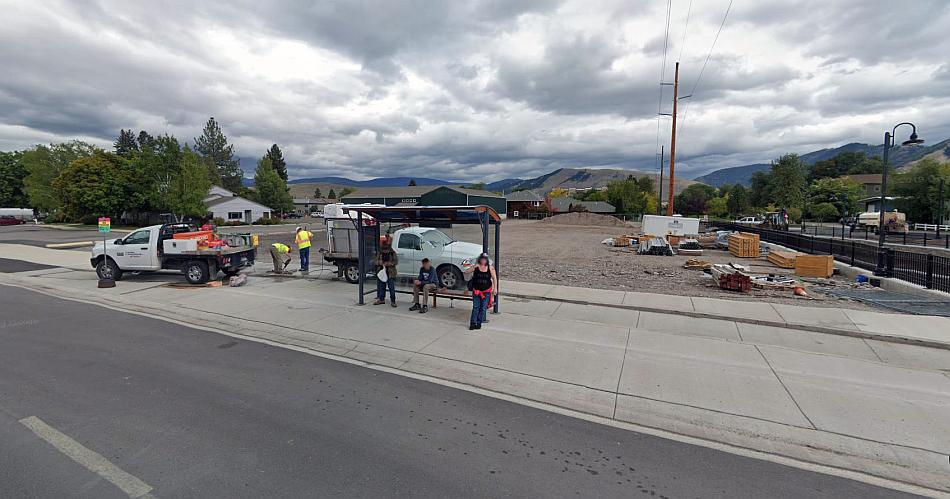
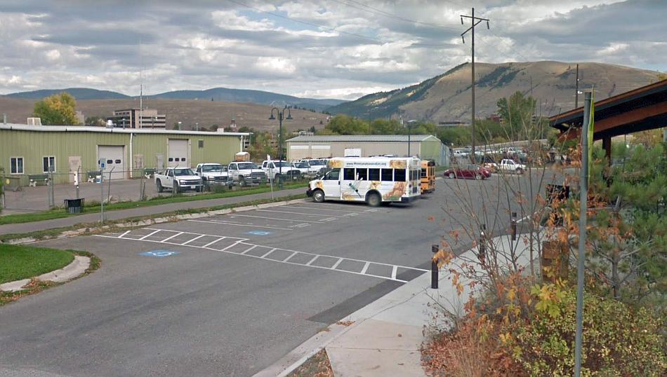
The course of the line on the other side of the city now incorporates a bus stop! The usual giveaway for the former rail route being the power lines. Google Streets.
Through the western part of the city from Russell Street onward is the Milwaukee Trail. This runs mostly along the former railroad alignment and the first bit begins opposite where the above bus stop is.
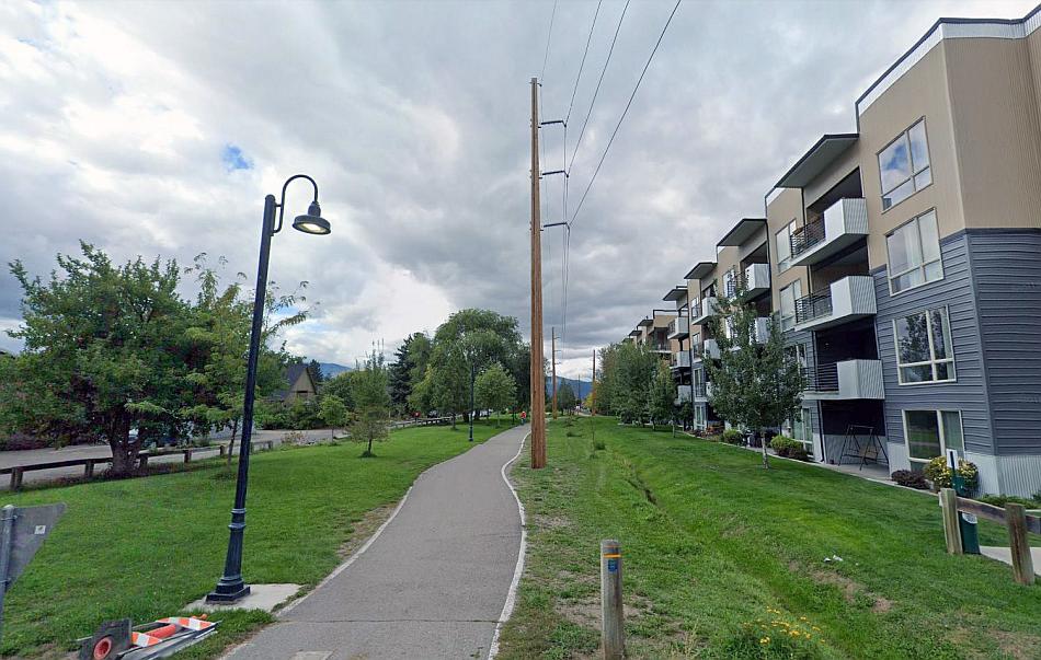
This is the Milwaukee trail a block further up from Russell Street. The giveaway is the power lines as usual! Google Streets.
The trail extends for a few more blocks, however that is as far as one can go. The alignment leading across the Clark Fork River out of the city is on private land – thus this is the end of part two of this feature!
Part Three: Missoula to Saltese
The full list of posts featuring the Milwaukee’s Rockies Mountains electric division:
Introduction:
Electric Railroad through the Rockies
Electric Railroad through the Rockies #2
Milwaukee Road then and now – Harlowton to Avery:
Part One: Harlowton to Butte
Part Two: Butte to Missoula
Part Three: Missoula to Saltese
Part Four: Dominion to Avery
Milwaukee Picture Galleries: